You are here: Home > Network List > TA - USArray Transportable Network (new EarthScope stations) Stations List
> Station H40A Chili, WI, USA > Earthquake Result Viewer
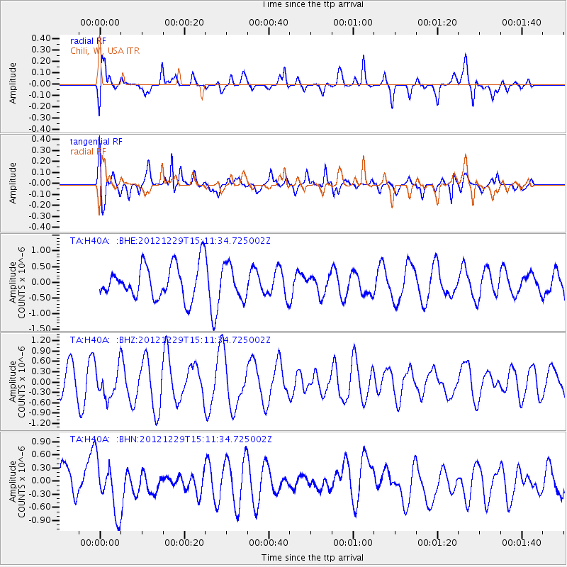
H40A Chili, WI, USA - Earthquake Result Viewer
*The percent match for this event was below the threshold and hence no stack was calculated.
| Earthquake location: |
Near East Coast Of Honshu, Japan |
| Earthquake latitude/longitude: |
38.7/142.0 |
| Earthquake time(UTC): |
2012/12/29 (364) 14:59:38 GMT |
| Earthquake Depth: |
56 km |
| Earthquake Magnitude: |
5.5 MW, 5.4 MW, 5.4 MB |
| Earthquake Catalog/Contributor: |
WHDF/NEIC |
|
| Network: |
TA USArray Transportable Network (new EarthScope stations) |
| Station: |
H40A Chili, WI, USA |
| Lat/Lon: |
44.62 N/90.39 W |
| Elevation: |
372 m |
|
| Distance: |
84.5 deg |
| Az: |
34.646 deg |
| Baz: |
321.494 deg |
| Ray Param: |
$rayparam |
*The percent match for this event was below the threshold and hence was not used in the summary stack. |
|
| Radial Match: |
44.456303 % |
| Radial Bump: |
400 |
| Transverse Match: |
66.132866 % |
| Transverse Bump: |
400 |
| SOD ConfigId: |
491031 |
| Insert Time: |
2013-04-10 04:40:26.877 +0000 |
| GWidth: |
2.5 |
| Max Bumps: |
400 |
| Tol: |
0.001 |
|
Signal To Noise
| Channel | StoN | STA | LTA |
| TA:H40A: :BHZ:20121229T15:11:34.725002Z | 0.85653085 | 4.2544568E-7 | 4.967079E-7 |
| TA:H40A: :BHN:20121229T15:11:34.725002Z | 2.0598414 | 5.925864E-7 | 2.8768542E-7 |
| TA:H40A: :BHE:20121229T15:11:34.725002Z | 0.99075246 | 5.2543345E-7 | 5.303378E-7 |
| Arrivals |
| Ps | |
| PpPs | |
| PsPs/PpSs | |


