You are here: Home > Network List > TA - USArray Transportable Network (new EarthScope stations) Stations List
> Station P46A Rosedale, IN, USA > Earthquake Result Viewer
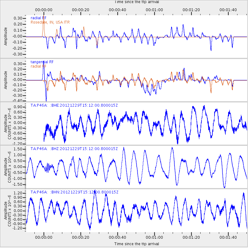
P46A Rosedale, IN, USA - Earthquake Result Viewer
*The percent match for this event was below the threshold and hence no stack was calculated.
| Earthquake location: |
Near East Coast Of Honshu, Japan |
| Earthquake latitude/longitude: |
38.7/142.0 |
| Earthquake time(UTC): |
2012/12/29 (364) 14:59:38 GMT |
| Earthquake Depth: |
56 km |
| Earthquake Magnitude: |
5.5 MW, 5.4 MW, 5.4 MB |
| Earthquake Catalog/Contributor: |
WHDF/NEIC |
|
| Network: |
TA USArray Transportable Network (new EarthScope stations) |
| Station: |
P46A Rosedale, IN, USA |
| Lat/Lon: |
39.62 N/87.21 W |
| Elevation: |
194 m |
|
| Distance: |
89.9 deg |
| Az: |
35.802 deg |
| Baz: |
323.68 deg |
| Ray Param: |
$rayparam |
*The percent match for this event was below the threshold and hence was not used in the summary stack. |
|
| Radial Match: |
41.1204 % |
| Radial Bump: |
400 |
| Transverse Match: |
58.13631 % |
| Transverse Bump: |
400 |
| SOD ConfigId: |
491031 |
| Insert Time: |
2013-04-10 04:41:10.947 +0000 |
| GWidth: |
2.5 |
| Max Bumps: |
400 |
| Tol: |
0.001 |
|
Signal To Noise
| Channel | StoN | STA | LTA |
| TA:P46A: :BHZ:20121229T15:12:00.800015Z | 0.37568408 | 1.9160792E-7 | 5.100241E-7 |
| TA:P46A: :BHN:20121229T15:12:00.800015Z | 0.68589807 | 5.2930164E-7 | 7.716914E-7 |
| TA:P46A: :BHE:20121229T15:12:00.800015Z | 1.1501597 | 4.6498425E-7 | 4.0427798E-7 |
| Arrivals |
| Ps | |
| PpPs | |
| PsPs/PpSs | |


