You are here: Home > Network List > TA - USArray Transportable Network (new EarthScope stations) Stations List
> Station U46A Springville, TN, USA > Earthquake Result Viewer
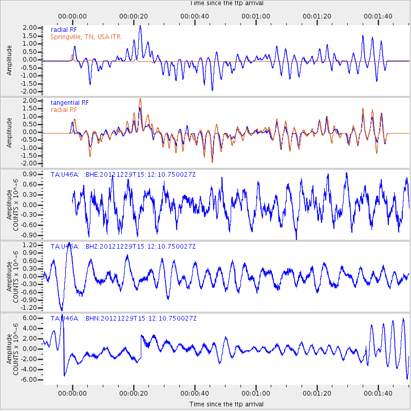
U46A Springville, TN, USA - Earthquake Result Viewer
*The percent match for this event was below the threshold and hence no stack was calculated.
| Earthquake location: |
Near East Coast Of Honshu, Japan |
| Earthquake latitude/longitude: |
38.7/142.0 |
| Earthquake time(UTC): |
2012/12/29 (364) 14:59:38 GMT |
| Earthquake Depth: |
56 km |
| Earthquake Magnitude: |
5.5 MW, 5.4 MW, 5.4 MB |
| Earthquake Catalog/Contributor: |
WHDF/NEIC |
|
| Network: |
TA USArray Transportable Network (new EarthScope stations) |
| Station: |
U46A Springville, TN, USA |
| Lat/Lon: |
36.36 N/88.18 W |
| Elevation: |
146 m |
|
| Distance: |
92.1 deg |
| Az: |
38.359 deg |
| Baz: |
323.04 deg |
| Ray Param: |
$rayparam |
*The percent match for this event was below the threshold and hence was not used in the summary stack. |
|
| Radial Match: |
41.79093 % |
| Radial Bump: |
400 |
| Transverse Match: |
43.298756 % |
| Transverse Bump: |
400 |
| SOD ConfigId: |
491031 |
| Insert Time: |
2013-04-10 04:41:22.956 +0000 |
| GWidth: |
2.5 |
| Max Bumps: |
400 |
| Tol: |
0.001 |
|
Signal To Noise
| Channel | StoN | STA | LTA |
| TA:U46A: :BHZ:20121229T15:12:10.750027Z | 1.2214282 | 6.1860106E-7 | 5.064572E-7 |
| TA:U46A: :BHN:20121229T15:12:10.750027Z | 1.1459047 | 2.7405504E-6 | 2.391604E-6 |
| TA:U46A: :BHE:20121229T15:12:10.750027Z | 0.8070964 | 3.1670152E-7 | 3.9239615E-7 |
| Arrivals |
| Ps | |
| PpPs | |
| PsPs/PpSs | |


