You are here: Home > Network List > TA - USArray Transportable Network (new EarthScope stations) Stations List
> Station D46A Sault St. Marie, ON, CAN > Earthquake Result Viewer
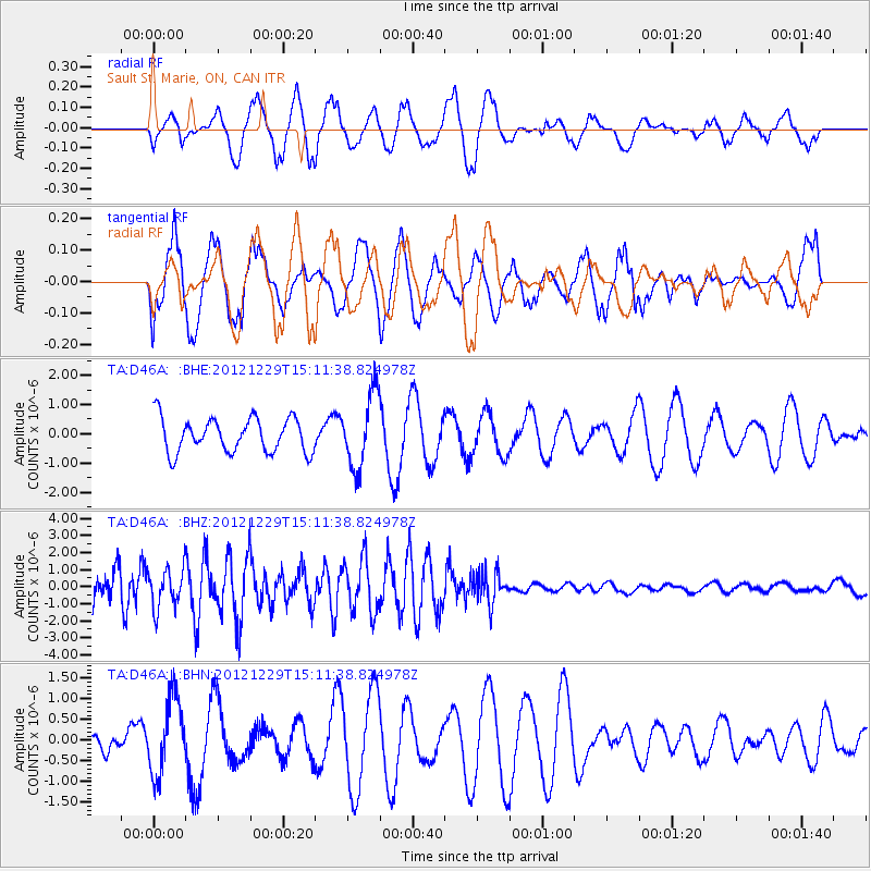
D46A Sault St. Marie, ON, CAN - Earthquake Result Viewer
*The percent match for this event was below the threshold and hence no stack was calculated.
| Earthquake location: |
Near East Coast Of Honshu, Japan |
| Earthquake latitude/longitude: |
38.7/142.0 |
| Earthquake time(UTC): |
2012/12/29 (364) 14:59:38 GMT |
| Earthquake Depth: |
56 km |
| Earthquake Magnitude: |
5.5 MW, 5.4 MW, 5.4 MB |
| Earthquake Catalog/Contributor: |
WHDF/NEIC |
|
| Network: |
TA USArray Transportable Network (new EarthScope stations) |
| Station: |
D46A Sault St. Marie, ON, CAN |
| Lat/Lon: |
46.89 N/84.04 W |
| Elevation: |
353 m |
|
| Distance: |
85.3 deg |
| Az: |
29.702 deg |
| Baz: |
325.597 deg |
| Ray Param: |
$rayparam |
*The percent match for this event was below the threshold and hence was not used in the summary stack. |
|
| Radial Match: |
62.155987 % |
| Radial Bump: |
400 |
| Transverse Match: |
27.887827 % |
| Transverse Bump: |
397 |
| SOD ConfigId: |
491031 |
| Insert Time: |
2013-04-10 04:43:16.539 +0000 |
| GWidth: |
2.5 |
| Max Bumps: |
400 |
| Tol: |
0.001 |
|
Signal To Noise
| Channel | StoN | STA | LTA |
| TA:D46A: :BHZ:20121229T15:11:38.824978Z | 1.4128675 | 1.138222E-6 | 8.0561125E-7 |
| TA:D46A: :BHN:20121229T15:11:38.824978Z | 2.6288817 | 9.1489966E-7 | 3.4801857E-7 |
| TA:D46A: :BHE:20121229T15:11:38.824978Z | 2.1696267 | 1.2577044E-6 | 5.79687E-7 |
| Arrivals |
| Ps | |
| PpPs | |
| PsPs/PpSs | |


