You are here: Home > Network List > CI - Caltech Regional Seismic Network Stations List
> Station MPM Manuel Prospect Mine, California, USA > Earthquake Result Viewer
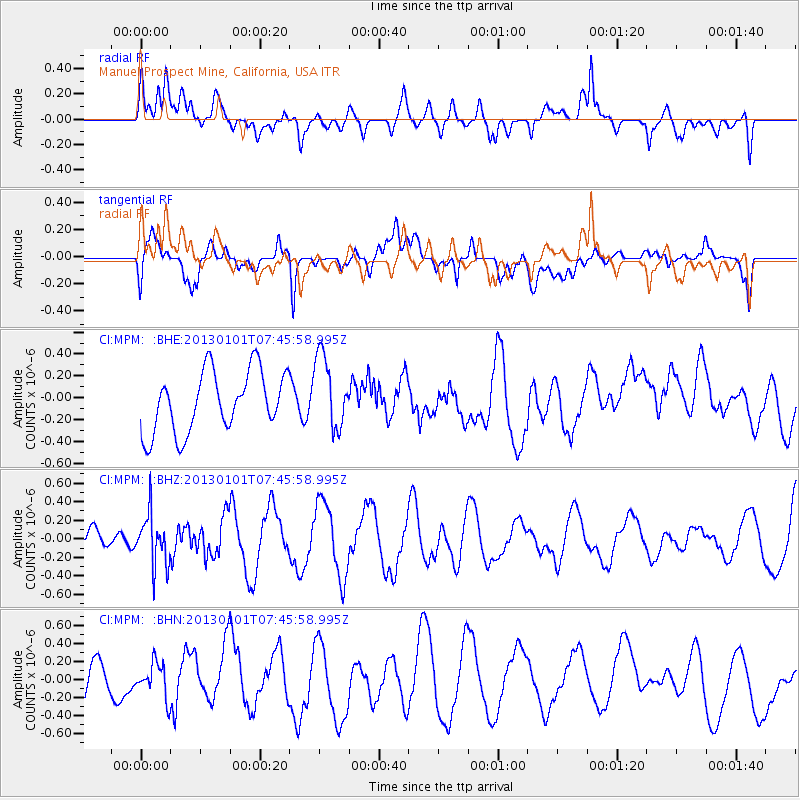
MPM Manuel Prospect Mine, California, USA - Earthquake Result Viewer
*The percent match for this event was below the threshold and hence no stack was calculated.
| Earthquake location: |
Kuril Islands |
| Earthquake latitude/longitude: |
46.9/151.1 |
| Earthquake time(UTC): |
2013/01/01 (001) 07:35:49 GMT |
| Earthquake Depth: |
35 km |
| Earthquake Magnitude: |
5.7 MB, 5.1 MW, 5.3 MW |
| Earthquake Catalog/Contributor: |
WHDF/NEIC |
|
| Network: |
CI Caltech Regional Seismic Network |
| Station: |
MPM Manuel Prospect Mine, California, USA |
| Lat/Lon: |
36.06 N/117.49 W |
| Elevation: |
185 m |
|
| Distance: |
65.7 deg |
| Az: |
62.764 deg |
| Baz: |
311.167 deg |
| Ray Param: |
$rayparam |
*The percent match for this event was below the threshold and hence was not used in the summary stack. |
|
| Radial Match: |
53.476936 % |
| Radial Bump: |
400 |
| Transverse Match: |
65.18059 % |
| Transverse Bump: |
400 |
| SOD ConfigId: |
492951 |
| Insert Time: |
2013-04-14 12:28:30.841 +0000 |
| GWidth: |
2.5 |
| Max Bumps: |
400 |
| Tol: |
0.001 |
|
Signal To Noise
| Channel | StoN | STA | LTA |
| CI:MPM: :BHZ:20130101T07:45:58.995Z | 1.0799559 | 2.7846133E-7 | 2.5784507E-7 |
| CI:MPM: :BHN:20130101T07:45:58.995Z | 0.7068226 | 1.8698401E-7 | 2.6454163E-7 |
| CI:MPM: :BHE:20130101T07:45:58.995Z | 1.2156259 | 3.3616905E-7 | 2.765399E-7 |
| Arrivals |
| Ps | |
| PpPs | |
| PsPs/PpSs | |


