You are here: Home > Network List > TA - USArray Transportable Network (new EarthScope stations) Stations List
> Station W44A Shelby Farms Park, Memphis, TN, USA > Earthquake Result Viewer
W44A Shelby Farms Park, Memphis, TN, USA - Earthquake Result Viewer
*The percent match for this event was below the threshold and hence no stack was calculated.
| Earthquake location: |
Kuril Islands |
| Earthquake latitude/longitude: |
46.9/151.1 |
| Earthquake time(UTC): |
2013/01/01 (001) 07:35:49 GMT |
| Earthquake Depth: |
35 km |
| Earthquake Magnitude: |
5.7 MB, 5.1 MW, 5.3 MW |
| Earthquake Catalog/Contributor: |
WHDF/NEIC |
|
| Network: |
TA USArray Transportable Network (new EarthScope stations) |
| Station: |
W44A Shelby Farms Park, Memphis, TN, USA |
| Lat/Lon: |
35.14 N/89.82 W |
| Elevation: |
101 m |
|
| Distance: |
81.8 deg |
| Az: |
46.338 deg |
| Baz: |
322.73 deg |
| Ray Param: |
$rayparam |
*The percent match for this event was below the threshold and hence was not used in the summary stack. |
|
| Radial Match: |
61.386425 % |
| Radial Bump: |
400 |
| Transverse Match: |
78.81035 % |
| Transverse Bump: |
400 |
| SOD ConfigId: |
492951 |
| Insert Time: |
2013-04-14 12:33:41.008 +0000 |
| GWidth: |
2.5 |
| Max Bumps: |
400 |
| Tol: |
0.001 |
|
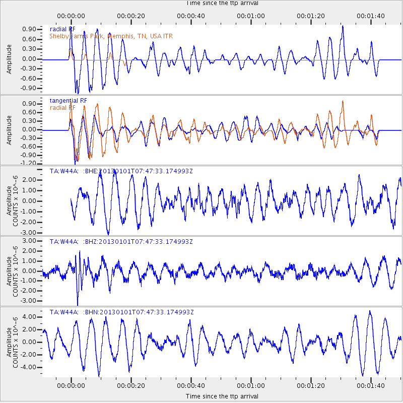
Signal To Noise
| Channel | StoN | STA | LTA |
| TA:W44A: :BHZ:20130101T07:47:33.174993Z | 2.1089518 | 1.2108314E-6 | 5.74139E-7 |
| TA:W44A: :BHN:20130101T07:47:33.174993Z | 1.3830959 | 2.5439456E-6 | 1.8393125E-6 |
| TA:W44A: :BHE:20130101T07:47:33.174993Z | 0.38811052 | 6.256418E-7 | 1.6120198E-6 |
| Arrivals |
| Ps | |
| PpPs | |
| PsPs/PpSs | |


