You are here: Home > Network List > TA - USArray Transportable Network (new EarthScope stations) Stations List
> Station O45A Potomac, IL, USA > Earthquake Result Viewer
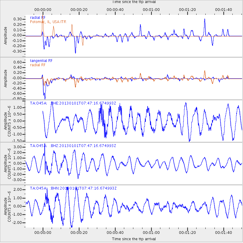
O45A Potomac, IL, USA - Earthquake Result Viewer
*The percent match for this event was below the threshold and hence no stack was calculated.
| Earthquake location: |
Kuril Islands |
| Earthquake latitude/longitude: |
46.9/151.1 |
| Earthquake time(UTC): |
2013/01/01 (001) 07:35:49 GMT |
| Earthquake Depth: |
35 km |
| Earthquake Magnitude: |
5.7 MB, 5.1 MW, 5.3 MW |
| Earthquake Catalog/Contributor: |
WHDF/NEIC |
|
| Network: |
TA USArray Transportable Network (new EarthScope stations) |
| Station: |
O45A Potomac, IL, USA |
| Lat/Lon: |
40.25 N/87.72 W |
| Elevation: |
208 m |
|
| Distance: |
78.7 deg |
| Az: |
41.878 deg |
| Baz: |
323.248 deg |
| Ray Param: |
$rayparam |
*The percent match for this event was below the threshold and hence was not used in the summary stack. |
|
| Radial Match: |
67.53625 % |
| Radial Bump: |
400 |
| Transverse Match: |
92.08117 % |
| Transverse Bump: |
339 |
| SOD ConfigId: |
492951 |
| Insert Time: |
2013-04-14 12:34:43.601 +0000 |
| GWidth: |
2.5 |
| Max Bumps: |
400 |
| Tol: |
0.001 |
|
Signal To Noise
| Channel | StoN | STA | LTA |
| TA:O45A: :BHZ:20130101T07:47:16.674993Z | 2.1866007 | 1.4034109E-6 | 6.4182314E-7 |
| TA:O45A: :BHN:20130101T07:47:16.674993Z | 1.7273136 | 8.695643E-7 | 5.0342004E-7 |
| TA:O45A: :BHE:20130101T07:47:16.674993Z | 1.291624 | 6.934899E-7 | 5.3691315E-7 |
| Arrivals |
| Ps | |
| PpPs | |
| PsPs/PpSs | |


