You are here: Home > Network List > TA - USArray Transportable Network (new EarthScope stations) Stations List
> Station X48A Hartselle, AL, USA > Earthquake Result Viewer
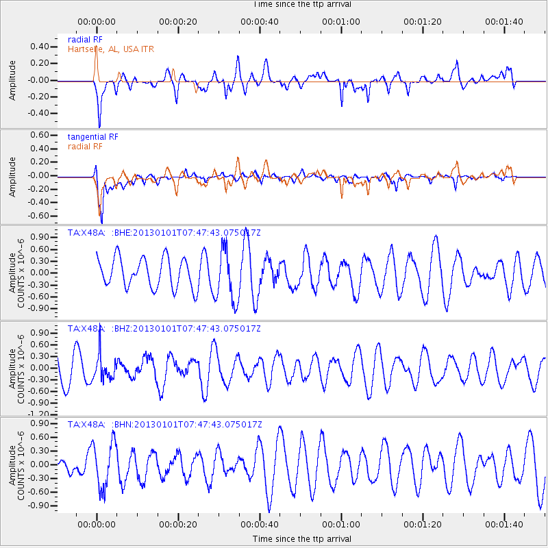
X48A Hartselle, AL, USA - Earthquake Result Viewer
*The percent match for this event was below the threshold and hence no stack was calculated.
| Earthquake location: |
Kuril Islands |
| Earthquake latitude/longitude: |
46.9/151.1 |
| Earthquake time(UTC): |
2013/01/01 (001) 07:35:49 GMT |
| Earthquake Depth: |
35 km |
| Earthquake Magnitude: |
5.7 MB, 5.1 MW, 5.3 MW |
| Earthquake Catalog/Contributor: |
WHDF/NEIC |
|
| Network: |
TA USArray Transportable Network (new EarthScope stations) |
| Station: |
X48A Hartselle, AL, USA |
| Lat/Lon: |
34.45 N/87.05 W |
| Elevation: |
180 m |
|
| Distance: |
83.7 deg |
| Az: |
44.904 deg |
| Baz: |
324.123 deg |
| Ray Param: |
$rayparam |
*The percent match for this event was below the threshold and hence was not used in the summary stack. |
|
| Radial Match: |
37.421093 % |
| Radial Bump: |
400 |
| Transverse Match: |
71.496414 % |
| Transverse Bump: |
400 |
| SOD ConfigId: |
492951 |
| Insert Time: |
2013-04-14 12:35:11.446 +0000 |
| GWidth: |
2.5 |
| Max Bumps: |
400 |
| Tol: |
0.001 |
|
Signal To Noise
| Channel | StoN | STA | LTA |
| TA:X48A: :BHZ:20130101T07:47:43.075017Z | 0.6361385 | 3.1421112E-7 | 4.939351E-7 |
| TA:X48A: :BHN:20130101T07:47:43.075017Z | 1.3162308 | 4.9515415E-7 | 3.7619097E-7 |
| TA:X48A: :BHE:20130101T07:47:43.075017Z | 1.7825894 | 6.626916E-7 | 3.7175784E-7 |
| Arrivals |
| Ps | |
| PpPs | |
| PsPs/PpSs | |


