You are here: Home > Network List > TA - USArray Transportable Network (new EarthScope stations) Stations List
> Station 355A Pearson, GA, USA > Earthquake Result Viewer
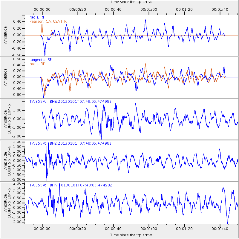
355A Pearson, GA, USA - Earthquake Result Viewer
*The percent match for this event was below the threshold and hence no stack was calculated.
| Earthquake location: |
Kuril Islands |
| Earthquake latitude/longitude: |
46.9/151.1 |
| Earthquake time(UTC): |
2013/01/01 (001) 07:35:49 GMT |
| Earthquake Depth: |
35 km |
| Earthquake Magnitude: |
5.7 MB, 5.1 MW, 5.3 MW |
| Earthquake Catalog/Contributor: |
WHDF/NEIC |
|
| Network: |
TA USArray Transportable Network (new EarthScope stations) |
| Station: |
355A Pearson, GA, USA |
| Lat/Lon: |
31.34 N/82.85 W |
| Elevation: |
69 m |
|
| Distance: |
88.2 deg |
| Az: |
43.771 deg |
| Baz: |
326.311 deg |
| Ray Param: |
$rayparam |
*The percent match for this event was below the threshold and hence was not used in the summary stack. |
|
| Radial Match: |
52.8327 % |
| Radial Bump: |
400 |
| Transverse Match: |
57.8809 % |
| Transverse Bump: |
400 |
| SOD ConfigId: |
492951 |
| Insert Time: |
2013-04-14 12:36:21.432 +0000 |
| GWidth: |
2.5 |
| Max Bumps: |
400 |
| Tol: |
0.001 |
|
Signal To Noise
| Channel | StoN | STA | LTA |
| TA:355A: :BHZ:20130101T07:48:05.47498Z | 3.7514663 | 8.1839994E-7 | 2.1815468E-7 |
| TA:355A: :BHN:20130101T07:48:05.47498Z | 1.1585134 | 6.543543E-7 | 5.648224E-7 |
| TA:355A: :BHE:20130101T07:48:05.47498Z | 2.0697768 | 1.1861226E-6 | 5.730679E-7 |
| Arrivals |
| Ps | |
| PpPs | |
| PsPs/PpSs | |


