You are here: Home > Network List > TA - USArray Transportable Network (new EarthScope stations) Stations List
> Station N60A Cedar Hill Farm, Mount Bethel, PA, USA > Earthquake Result Viewer
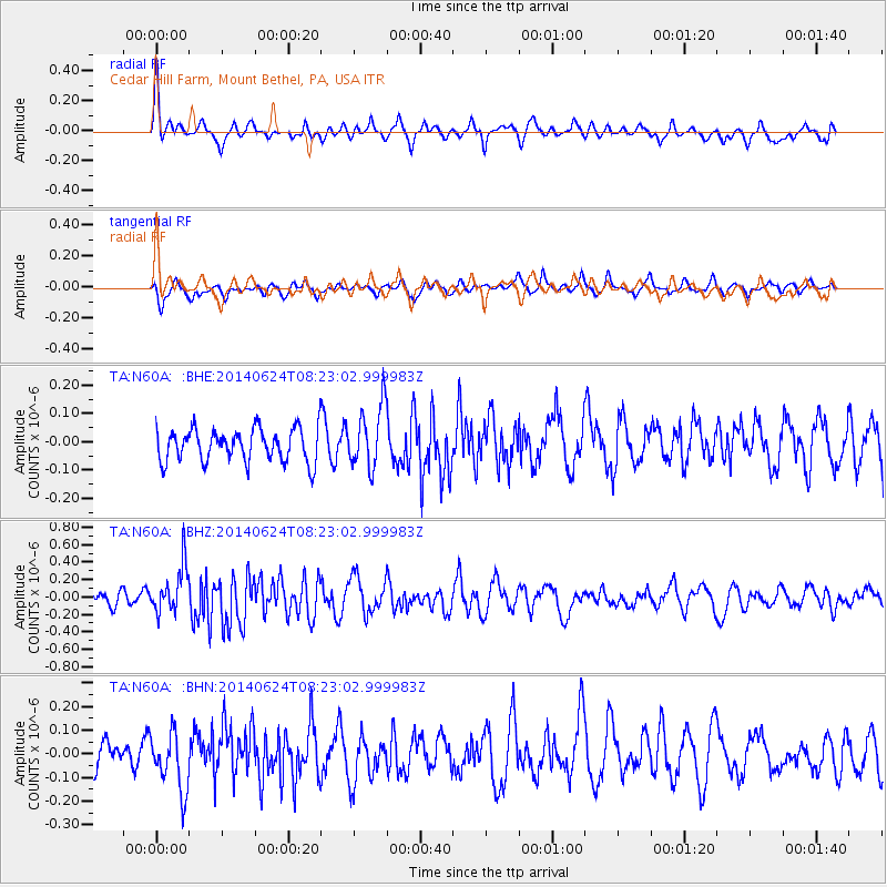
N60A Cedar Hill Farm, Mount Bethel, PA, USA - Earthquake Result Viewer
*The percent match for this event was below the threshold and hence no stack was calculated.
| Earthquake location: |
Rat Islands, Aleutian Islands |
| Earthquake latitude/longitude: |
52.2/176.6 |
| Earthquake time(UTC): |
2014/06/24 (175) 08:12:33 GMT |
| Earthquake Depth: |
23 km |
| Earthquake Magnitude: |
5.8 MW |
| Earthquake Catalog/Contributor: |
ISC/ISC |
|
| Network: |
TA USArray Transportable Network (new EarthScope stations) |
| Station: |
N60A Cedar Hill Farm, Mount Bethel, PA, USA |
| Lat/Lon: |
40.87 N/75.10 W |
| Elevation: |
189 m |
|
| Distance: |
68.5 deg |
| Az: |
50.699 deg |
| Baz: |
321.079 deg |
| Ray Param: |
$rayparam |
*The percent match for this event was below the threshold and hence was not used in the summary stack. |
|
| Radial Match: |
67.08985 % |
| Radial Bump: |
363 |
| Transverse Match: |
63.079475 % |
| Transverse Bump: |
400 |
| SOD ConfigId: |
3390531 |
| Insert Time: |
2019-04-12 12:45:29.992 +0000 |
| GWidth: |
2.5 |
| Max Bumps: |
400 |
| Tol: |
0.001 |
|
Signal To Noise
| Channel | StoN | STA | LTA |
| TA:N60A: :BHZ:20140624T08:23:02.999983Z | 3.2757869 | 2.6970432E-7 | 8.233268E-8 |
| TA:N60A: :BHN:20140624T08:23:02.999983Z | 1.5827106 | 1.2161067E-7 | 7.683696E-8 |
| TA:N60A: :BHE:20140624T08:23:02.999983Z | 1.9039782 | 1.0992482E-7 | 5.7734283E-8 |
| Arrivals |
| Ps | |
| PpPs | |
| PsPs/PpSs | |


