You are here: Home > Network List > TA - USArray Transportable Network (new EarthScope stations) Stations List
> Station Q53A Leroy, WV, USA > Earthquake Result Viewer
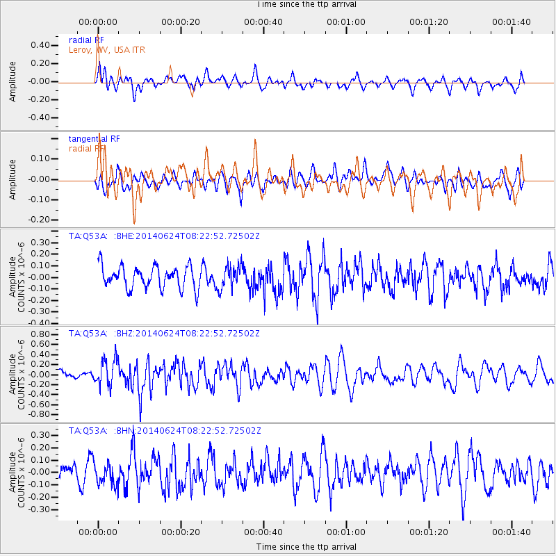
Q53A Leroy, WV, USA - Earthquake Result Viewer
*The percent match for this event was below the threshold and hence no stack was calculated.
| Earthquake location: |
Rat Islands, Aleutian Islands |
| Earthquake latitude/longitude: |
52.2/176.6 |
| Earthquake time(UTC): |
2014/06/24 (175) 08:12:33 GMT |
| Earthquake Depth: |
23 km |
| Earthquake Magnitude: |
5.8 MW |
| Earthquake Catalog/Contributor: |
ISC/ISC |
|
| Network: |
TA USArray Transportable Network (new EarthScope stations) |
| Station: |
Q53A Leroy, WV, USA |
| Lat/Lon: |
38.86 N/81.53 W |
| Elevation: |
310 m |
|
| Distance: |
66.8 deg |
| Az: |
56.191 deg |
| Baz: |
319.063 deg |
| Ray Param: |
$rayparam |
*The percent match for this event was below the threshold and hence was not used in the summary stack. |
|
| Radial Match: |
48.941635 % |
| Radial Bump: |
400 |
| Transverse Match: |
43.743134 % |
| Transverse Bump: |
400 |
| SOD ConfigId: |
3390531 |
| Insert Time: |
2019-04-12 12:45:40.504 +0000 |
| GWidth: |
2.5 |
| Max Bumps: |
400 |
| Tol: |
0.001 |
|
Signal To Noise
| Channel | StoN | STA | LTA |
| TA:Q53A: :BHZ:20140624T08:22:52.72502Z | 2.4207034 | 2.7844038E-7 | 1.15024584E-7 |
| TA:Q53A: :BHN:20140624T08:22:52.72502Z | 0.9651045 | 8.6730424E-8 | 8.9866354E-8 |
| TA:Q53A: :BHE:20140624T08:22:52.72502Z | 1.0601802 | 1.01321994E-7 | 9.557054E-8 |
| Arrivals |
| Ps | |
| PpPs | |
| PsPs/PpSs | |


