You are here: Home > Network List > US - United States National Seismic Network Stations List
> Station CBKS Cedar Bluff, Kansas, USA > Earthquake Result Viewer
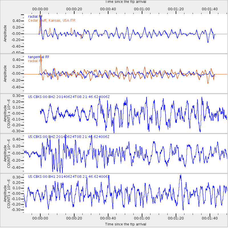
CBKS Cedar Bluff, Kansas, USA - Earthquake Result Viewer
*The percent match for this event was below the threshold and hence no stack was calculated.
| Earthquake location: |
Rat Islands, Aleutian Islands |
| Earthquake latitude/longitude: |
52.2/176.6 |
| Earthquake time(UTC): |
2014/06/24 (175) 08:12:33 GMT |
| Earthquake Depth: |
23 km |
| Earthquake Magnitude: |
5.8 MW |
| Earthquake Catalog/Contributor: |
ISC/ISC |
|
| Network: |
US United States National Seismic Network |
| Station: |
CBKS Cedar Bluff, Kansas, USA |
| Lat/Lon: |
38.81 N/99.74 W |
| Elevation: |
677 m |
|
| Distance: |
57.0 deg |
| Az: |
67.813 deg |
| Baz: |
313.135 deg |
| Ray Param: |
$rayparam |
*The percent match for this event was below the threshold and hence was not used in the summary stack. |
|
| Radial Match: |
67.18878 % |
| Radial Bump: |
400 |
| Transverse Match: |
50.791233 % |
| Transverse Bump: |
400 |
| SOD ConfigId: |
3390531 |
| Insert Time: |
2019-04-12 12:46:29.846 +0000 |
| GWidth: |
2.5 |
| Max Bumps: |
400 |
| Tol: |
0.001 |
|
Signal To Noise
| Channel | StoN | STA | LTA |
| US:CBKS:00:BHZ:20140624T08:21:46.624006Z | 3.4882085 | 2.0167785E-7 | 5.7817026E-8 |
| US:CBKS:00:BH1:20140624T08:21:46.624006Z | 0.9945123 | 1.02754335E-7 | 1.03321334E-7 |
| US:CBKS:00:BH2:20140624T08:21:46.624006Z | 1.6877483 | 1.1345274E-7 | 6.7221364E-8 |
| Arrivals |
| Ps | |
| PpPs | |
| PsPs/PpSs | |


