You are here: Home > Network List > TA - USArray Transportable Network (new EarthScope stations) Stations List
> Station 453A Whigham, GA, USA > Earthquake Result Viewer
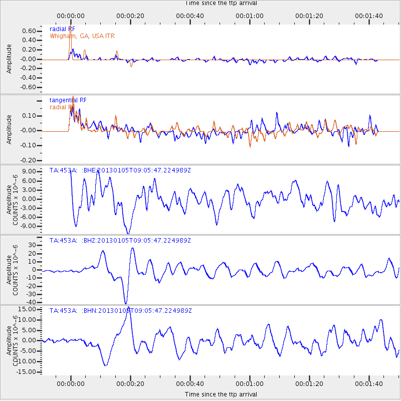
453A Whigham, GA, USA - Earthquake Result Viewer
*The percent match for this event was below the threshold and hence no stack was calculated.
| Earthquake location: |
Southeastern Alaska |
| Earthquake latitude/longitude: |
55.4/-134.7 |
| Earthquake time(UTC): |
2013/01/05 (005) 08:58:19 GMT |
| Earthquake Depth: |
10 km |
| Earthquake Magnitude: |
6.4 MB, 7.7 MS, 7.5 MW, 7.5 MW |
| Earthquake Catalog/Contributor: |
WHDF/NEIC |
|
| Network: |
TA USArray Transportable Network (new EarthScope stations) |
| Station: |
453A Whigham, GA, USA |
| Lat/Lon: |
30.85 N/84.32 W |
| Elevation: |
82 m |
|
| Distance: |
42.9 deg |
| Az: |
103.563 deg |
| Baz: |
319.841 deg |
| Ray Param: |
$rayparam |
*The percent match for this event was below the threshold and hence was not used in the summary stack. |
|
| Radial Match: |
66.72585 % |
| Radial Bump: |
400 |
| Transverse Match: |
63.50222 % |
| Transverse Bump: |
400 |
| SOD ConfigId: |
492951 |
| Insert Time: |
2013-04-14 13:13:31.623 +0000 |
| GWidth: |
2.5 |
| Max Bumps: |
400 |
| Tol: |
0.001 |
|
Signal To Noise
| Channel | StoN | STA | LTA |
| TA:453A: :BHZ:20130105T09:05:47.224989Z | 2.141469 | 1.3354605E-6 | 6.236189E-7 |
| TA:453A: :BHN:20130105T09:05:47.224989Z | 1.2907598 | 8.268999E-7 | 6.4063033E-7 |
| TA:453A: :BHE:20130105T09:05:47.224989Z | 0.32852554 | 1.7279959E-6 | 5.259853E-6 |
| Arrivals |
| Ps | |
| PpPs | |
| PsPs/PpSs | |


