You are here: Home > Network List > TA - USArray Transportable Network (new EarthScope stations) Stations List
> Station 357A Townsend, GA, USA > Earthquake Result Viewer
357A Townsend, GA, USA - Earthquake Result Viewer

| Earthquake location: |
Southeastern Alaska |
| Earthquake latitude/longitude: |
55.4/-134.7 |
| Earthquake time(UTC): |
2013/01/05 (005) 08:58:19 GMT |
| Earthquake Depth: |
10 km |
| Earthquake Magnitude: |
6.4 MB, 7.7 MS, 7.5 MW, 7.5 MW |
| Earthquake Catalog/Contributor: |
WHDF/NEIC |
|
| Network: |
TA USArray Transportable Network (new EarthScope stations) |
| Station: |
357A Townsend, GA, USA |
| Lat/Lon: |
31.42 N/81.49 W |
| Elevation: |
7.0 m |
|
| Distance: |
44.1 deg |
| Az: |
100.345 deg |
| Baz: |
318.965 deg |
| Ray Param: |
0.07214288 |
| Estimated Moho Depth: |
10.75 km |
| Estimated Crust Vp/Vs: |
1.88 |
| Assumed Crust Vp: |
5.989 km/s |
| Estimated Crust Vs: |
3.177 km/s |
| Estimated Crust Poisson's Ratio: |
0.30 |
|
| Radial Match: |
93.12582 % |
| Radial Bump: |
311 |
| Transverse Match: |
72.360344 % |
| Transverse Bump: |
400 |
| SOD ConfigId: |
492951 |
| Insert Time: |
2013-04-14 13:15:00.330 +0000 |
| GWidth: |
2.5 |
| Max Bumps: |
400 |
| Tol: |
0.001 |
|
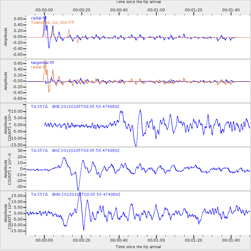
Signal To Noise
| Channel | StoN | STA | LTA |
| TA:357A: :BHZ:20130105T09:05:56.474989Z | 1.8992451 | 1.2415502E-6 | 6.5370716E-7 |
| TA:357A: :BHN:20130105T09:05:56.474989Z | 1.7100188 | 1.2549808E-6 | 7.3389884E-7 |
| TA:357A: :BHE:20130105T09:05:56.474989Z | 1.0100513 | 9.089832E-7 | 8.999378E-7 |
| Arrivals |
| Ps | 1.7 SECOND |
| PpPs | 4.9 SECOND |
| PsPs/PpSs | 6.6 SECOND |


