You are here: Home > Network List > US - United States National Seismic Network Stations List
> Station MSO Missoula, Montana, USA > Earthquake Result Viewer
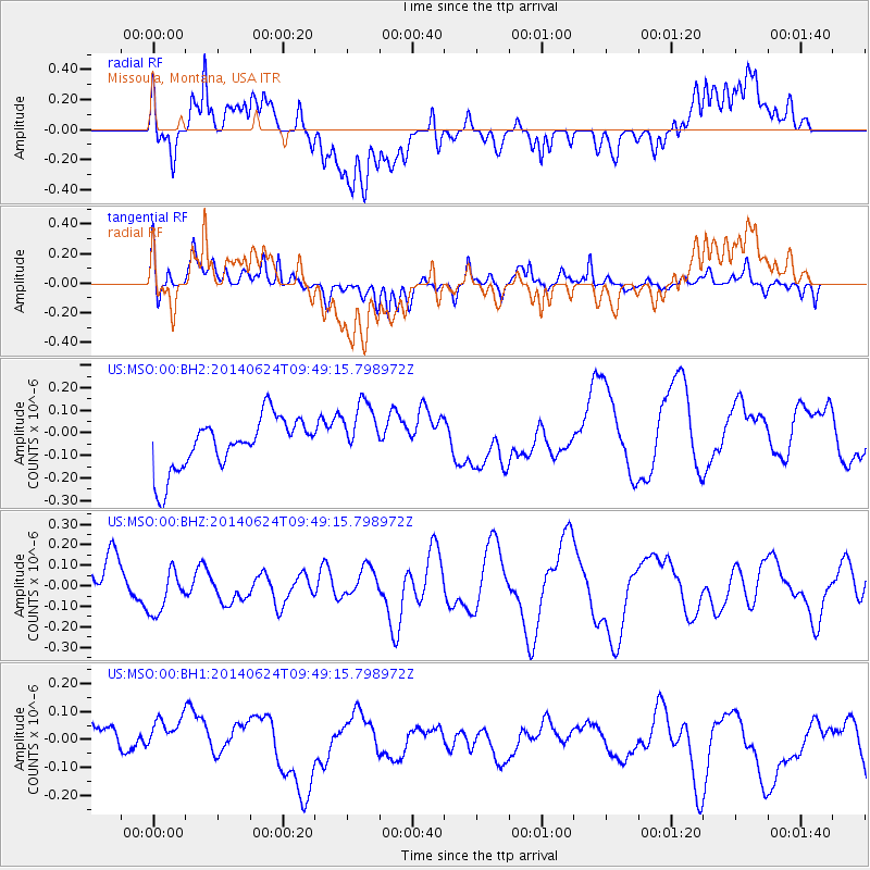
MSO Missoula, Montana, USA - Earthquake Result Viewer
*The percent match for this event was below the threshold and hence no stack was calculated.
| Earthquake location: |
Kermadec Islands, New Zealand |
| Earthquake latitude/longitude: |
-30.3/-177.3 |
| Earthquake time(UTC): |
2014/06/24 (175) 09:36:25 GMT |
| Earthquake Depth: |
33 km |
| Earthquake Magnitude: |
4.9 mb |
| Earthquake Catalog/Contributor: |
ISC/ISC |
|
| Network: |
US United States National Seismic Network |
| Station: |
MSO Missoula, Montana, USA |
| Lat/Lon: |
46.83 N/113.94 W |
| Elevation: |
1264 m |
|
| Distance: |
95.6 deg |
| Az: |
38.071 deg |
| Baz: |
230.971 deg |
| Ray Param: |
$rayparam |
*The percent match for this event was below the threshold and hence was not used in the summary stack. |
|
| Radial Match: |
51.79438 % |
| Radial Bump: |
400 |
| Transverse Match: |
60.786858 % |
| Transverse Bump: |
400 |
| SOD ConfigId: |
3390531 |
| Insert Time: |
2019-04-12 12:52:58.560 +0000 |
| GWidth: |
2.5 |
| Max Bumps: |
400 |
| Tol: |
0.001 |
|
Signal To Noise
| Channel | StoN | STA | LTA |
| US:MSO:00:BHZ:20140624T09:49:15.798972Z | 1.2258059 | 1.1119793E-7 | 9.0714146E-8 |
| US:MSO:00:BH1:20140624T09:49:15.798972Z | 0.9912019 | 1.06079256E-7 | 1.0702083E-7 |
| US:MSO:00:BH2:20140624T09:49:15.798972Z | 1.1792157 | 1.3486509E-7 | 1.1436847E-7 |
| Arrivals |
| Ps | |
| PpPs | |
| PsPs/PpSs | |


