You are here: Home > Network List > TA - USArray Transportable Network (new EarthScope stations) Stations List
> Station N51A Ashland, OH, USA > Earthquake Result Viewer
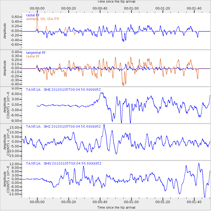
N51A Ashland, OH, USA - Earthquake Result Viewer
*The percent match for this event was below the threshold and hence no stack was calculated.
| Earthquake location: |
Southeastern Alaska |
| Earthquake latitude/longitude: |
55.4/-134.7 |
| Earthquake time(UTC): |
2013/01/05 (005) 08:58:19 GMT |
| Earthquake Depth: |
10 km |
| Earthquake Magnitude: |
6.4 MB, 7.7 MS, 7.5 MW, 7.5 MW |
| Earthquake Catalog/Contributor: |
WHDF/NEIC |
|
| Network: |
TA USArray Transportable Network (new EarthScope stations) |
| Station: |
N51A Ashland, OH, USA |
| Lat/Lon: |
40.92 N/82.37 W |
| Elevation: |
343 m |
|
| Distance: |
36.8 deg |
| Az: |
90.817 deg |
| Baz: |
311.168 deg |
| Ray Param: |
$rayparam |
*The percent match for this event was below the threshold and hence was not used in the summary stack. |
|
| Radial Match: |
52.2941 % |
| Radial Bump: |
400 |
| Transverse Match: |
54.29042 % |
| Transverse Bump: |
400 |
| SOD ConfigId: |
492951 |
| Insert Time: |
2013-04-14 13:24:47.130 +0000 |
| GWidth: |
2.5 |
| Max Bumps: |
400 |
| Tol: |
0.001 |
|
Signal To Noise
| Channel | StoN | STA | LTA |
| TA:N51A: :BHZ:20130105T09:04:56.699995Z | 0.6844859 | 3.6964832E-6 | 5.400379E-6 |
| TA:N51A: :BHN:20130105T09:04:56.699995Z | 1.8543739 | 4.3707047E-7 | 2.3569706E-7 |
| TA:N51A: :BHE:20130105T09:04:56.699995Z | 1.7765046 | 4.6374916E-7 | 2.6104584E-7 |
| Arrivals |
| Ps | |
| PpPs | |
| PsPs/PpSs | |


