You are here: Home > Network List > TA - USArray Transportable Network (new EarthScope stations) Stations List
> Station V50A Pikevile, TN, USA > Earthquake Result Viewer
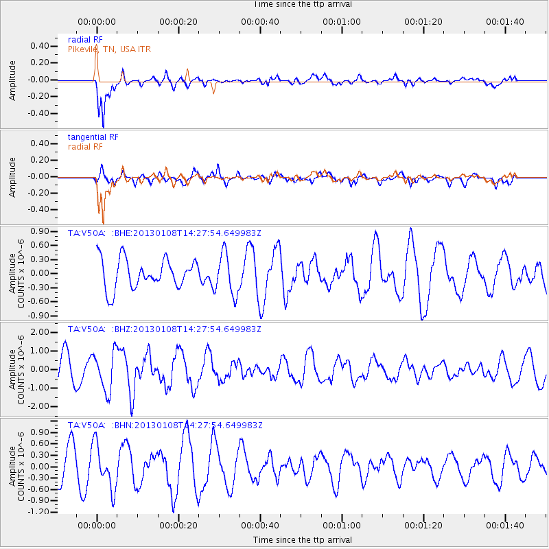
V50A Pikevile, TN, USA - Earthquake Result Viewer
*The percent match for this event was below the threshold and hence no stack was calculated.
| Earthquake location: |
Aegean Sea |
| Earthquake latitude/longitude: |
39.7/25.5 |
| Earthquake time(UTC): |
2013/01/08 (008) 14:16:08 GMT |
| Earthquake Depth: |
13 km |
| Earthquake Magnitude: |
5.7 MB, 5.8 MS, 5.7 MW, 5.7 MW |
| Earthquake Catalog/Contributor: |
WHDF/NEIC |
|
| Network: |
TA USArray Transportable Network (new EarthScope stations) |
| Station: |
V50A Pikevile, TN, USA |
| Lat/Lon: |
35.67 N/85.10 W |
| Elevation: |
287 m |
|
| Distance: |
81.5 deg |
| Az: |
309.612 deg |
| Baz: |
46.922 deg |
| Ray Param: |
$rayparam |
*The percent match for this event was below the threshold and hence was not used in the summary stack. |
|
| Radial Match: |
89.65882 % |
| Radial Bump: |
400 |
| Transverse Match: |
55.07034 % |
| Transverse Bump: |
400 |
| SOD ConfigId: |
493637 |
| Insert Time: |
2013-04-16 13:20:45.459 +0000 |
| GWidth: |
2.5 |
| Max Bumps: |
400 |
| Tol: |
0.001 |
|
Signal To Noise
| Channel | StoN | STA | LTA |
| TA:V50A: :BHZ:20130108T14:27:54.649983Z | 1.6771868 | 1.0606924E-6 | 6.324235E-7 |
| TA:V50A: :BHN:20130108T14:27:54.649983Z | 1.5815773 | 5.9070146E-7 | 3.734888E-7 |
| TA:V50A: :BHE:20130108T14:27:54.649983Z | 1.4249547 | 4.4431778E-7 | 3.1181187E-7 |
| Arrivals |
| Ps | |
| PpPs | |
| PsPs/PpSs | |


