You are here: Home > Network List > CN - Canadian National Seismograph Network Stations List
> Station FRB IQALUIT, N.W.T. > Earthquake Result Viewer
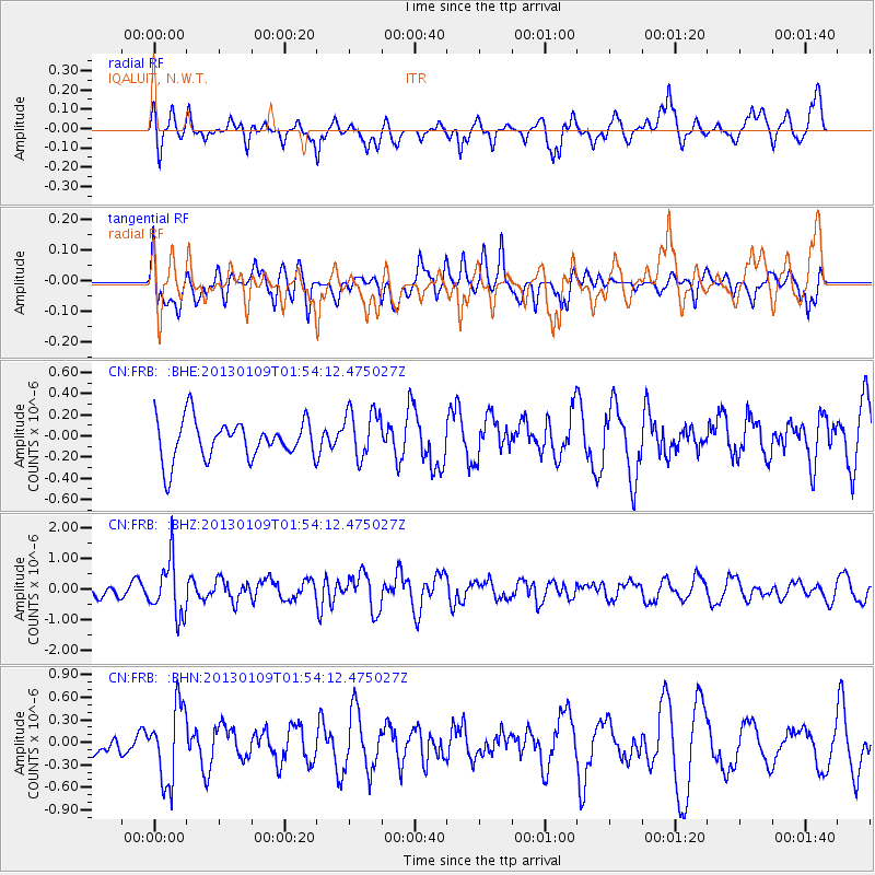
FRB IQALUIT, N.W.T. - Earthquake Result Viewer
*The percent match for this event was below the threshold and hence no stack was calculated.
| Earthquake location: |
Myanmar-India Border Region |
| Earthquake latitude/longitude: |
25.3/95.0 |
| Earthquake time(UTC): |
2013/01/09 (009) 01:41:53 GMT |
| Earthquake Depth: |
93 km |
| Earthquake Magnitude: |
5.8 MB, 5.8 MW, 5.8 MW |
| Earthquake Catalog/Contributor: |
WHDF/NEIC |
|
| Network: |
CN Canadian National Seismograph Network |
| Station: |
FRB IQALUIT, N.W.T. |
| Lat/Lon: |
63.75 N/68.55 W |
| Elevation: |
18 m |
|
| Distance: |
90.3 deg |
| Az: |
352.784 deg |
| Baz: |
14.809 deg |
| Ray Param: |
$rayparam |
*The percent match for this event was below the threshold and hence was not used in the summary stack. |
|
| Radial Match: |
62.827385 % |
| Radial Bump: |
396 |
| Transverse Match: |
57.548203 % |
| Transverse Bump: |
400 |
| SOD ConfigId: |
493637 |
| Insert Time: |
2013-04-16 13:32:38.886 +0000 |
| GWidth: |
2.5 |
| Max Bumps: |
400 |
| Tol: |
0.001 |
|
Signal To Noise
| Channel | StoN | STA | LTA |
| CN:FRB: :BHZ:20130109T01:54:12.475027Z | 2.7051282 | 8.994247E-7 | 3.3248875E-7 |
| CN:FRB: :BHN:20130109T01:54:12.475027Z | 2.1889117 | 5.008958E-7 | 2.2883326E-7 |
| CN:FRB: :BHE:20130109T01:54:12.475027Z | 1.263636 | 2.3556356E-7 | 1.8641725E-7 |
| Arrivals |
| Ps | |
| PpPs | |
| PsPs/PpSs | |


