You are here: Home > Network List > TA - USArray Transportable Network (new EarthScope stations) Stations List
> Station F39A Loretta, WI, USA > Earthquake Result Viewer
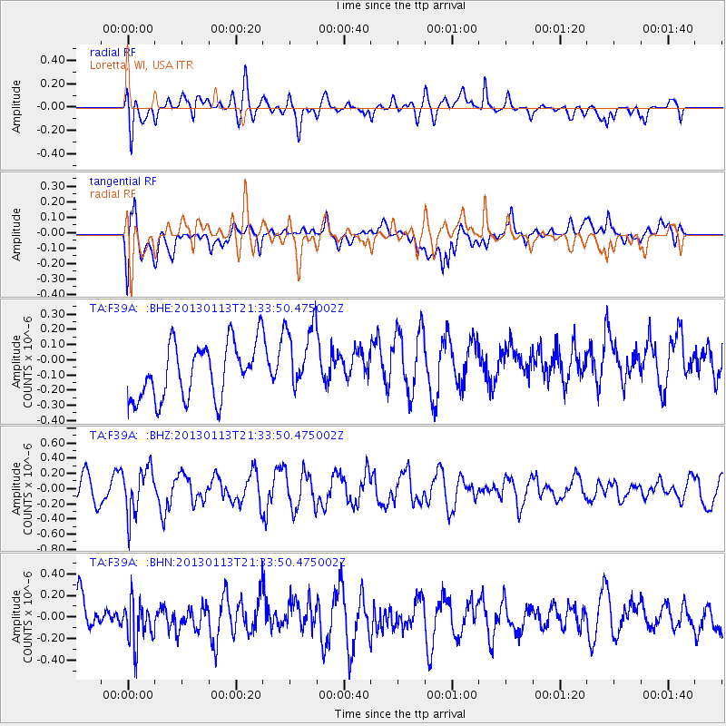
F39A Loretta, WI, USA - Earthquake Result Viewer
*The percent match for this event was below the threshold and hence no stack was calculated.
| Earthquake location: |
Northern Chile |
| Earthquake latitude/longitude: |
-20.1/-69.0 |
| Earthquake time(UTC): |
2013/01/13 (013) 21:23:26 GMT |
| Earthquake Depth: |
75 km |
| Earthquake Magnitude: |
5.5 MB, 5.3 MW, 5.3 MW |
| Earthquake Catalog/Contributor: |
WHDF/NEIC |
|
| Network: |
TA USArray Transportable Network (new EarthScope stations) |
| Station: |
F39A Loretta, WI, USA |
| Lat/Lon: |
45.92 N/90.92 W |
| Elevation: |
440 m |
|
| Distance: |
68.6 deg |
| Az: |
343.78 deg |
| Baz: |
157.906 deg |
| Ray Param: |
$rayparam |
*The percent match for this event was below the threshold and hence was not used in the summary stack. |
|
| Radial Match: |
46.194416 % |
| Radial Bump: |
400 |
| Transverse Match: |
56.825825 % |
| Transverse Bump: |
400 |
| SOD ConfigId: |
493637 |
| Insert Time: |
2013-04-16 14:28:11.973 +0000 |
| GWidth: |
2.5 |
| Max Bumps: |
400 |
| Tol: |
0.001 |
|
Signal To Noise
| Channel | StoN | STA | LTA |
| TA:F39A: :BHZ:20130113T21:33:50.475002Z | 1.2377486 | 3.0649213E-7 | 2.4762065E-7 |
| TA:F39A: :BHN:20130113T21:33:50.475002Z | 1.3477883 | 1.9824141E-7 | 1.4708645E-7 |
| TA:F39A: :BHE:20130113T21:33:50.475002Z | 1.2954044 | 2.347742E-7 | 1.8123622E-7 |
| Arrivals |
| Ps | |
| PpPs | |
| PsPs/PpSs | |


