You are here: Home > Network List > TA - USArray Transportable Network (new EarthScope stations) Stations List
> Station L43A Garden Prairie, IL, USA > Earthquake Result Viewer
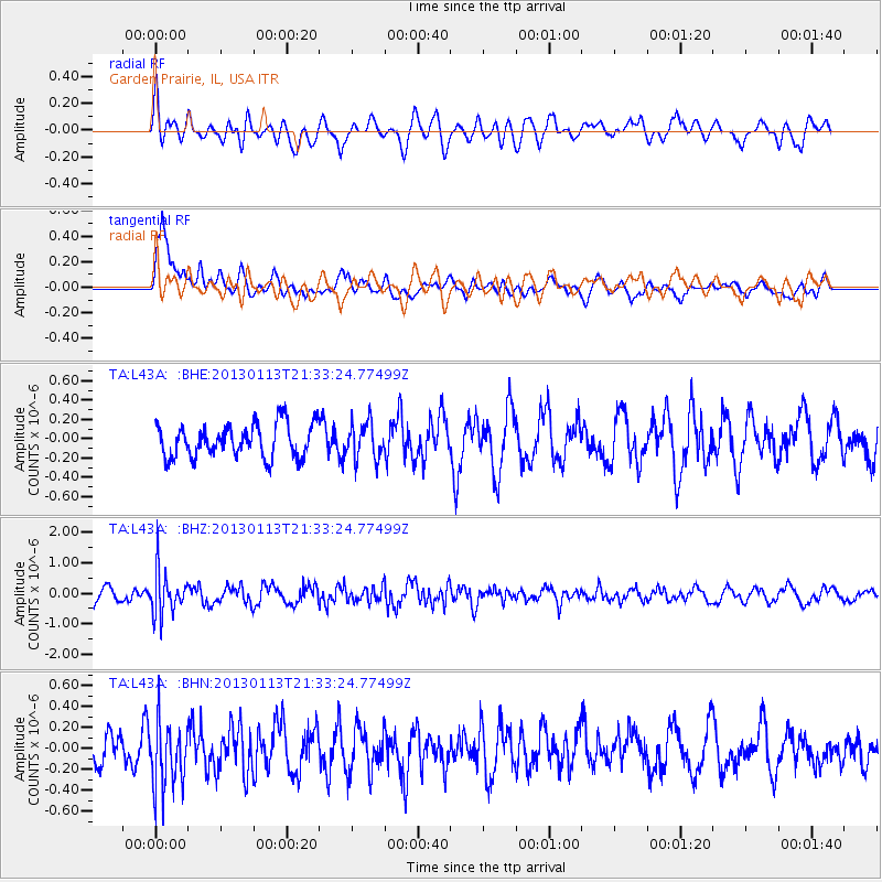
L43A Garden Prairie, IL, USA - Earthquake Result Viewer
*The percent match for this event was below the threshold and hence no stack was calculated.
| Earthquake location: |
Northern Chile |
| Earthquake latitude/longitude: |
-20.1/-69.0 |
| Earthquake time(UTC): |
2013/01/13 (013) 21:23:26 GMT |
| Earthquake Depth: |
75 km |
| Earthquake Magnitude: |
5.5 MB, 5.3 MW, 5.3 MW |
| Earthquake Catalog/Contributor: |
WHDF/NEIC |
|
| Network: |
TA USArray Transportable Network (new EarthScope stations) |
| Station: |
L43A Garden Prairie, IL, USA |
| Lat/Lon: |
42.18 N/88.74 W |
| Elevation: |
266 m |
|
| Distance: |
64.5 deg |
| Az: |
343.896 deg |
| Baz: |
159.461 deg |
| Ray Param: |
$rayparam |
*The percent match for this event was below the threshold and hence was not used in the summary stack. |
|
| Radial Match: |
64.52107 % |
| Radial Bump: |
400 |
| Transverse Match: |
71.72243 % |
| Transverse Bump: |
400 |
| SOD ConfigId: |
493637 |
| Insert Time: |
2013-04-16 14:29:27.275 +0000 |
| GWidth: |
2.5 |
| Max Bumps: |
400 |
| Tol: |
0.001 |
|
Signal To Noise
| Channel | StoN | STA | LTA |
| TA:L43A: :BHZ:20130113T21:33:24.77499Z | 3.5494945 | 7.1378764E-7 | 2.0109557E-7 |
| TA:L43A: :BHN:20130113T21:33:24.77499Z | 1.6383191 | 3.182402E-7 | 1.94248E-7 |
| TA:L43A: :BHE:20130113T21:33:24.77499Z | 1.0961757 | 1.8733964E-7 | 1.7090294E-7 |
| Arrivals |
| Ps | |
| PpPs | |
| PsPs/PpSs | |


