You are here: Home > Network List > TA - USArray Transportable Network (new EarthScope stations) Stations List
> Station R54A Victor, WV, USA > Earthquake Result Viewer
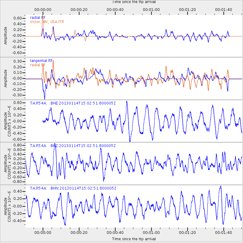
R54A Victor, WV, USA - Earthquake Result Viewer
*The percent match for this event was below the threshold and hence no stack was calculated.
| Earthquake location: |
Southeastern Alaska |
| Earthquake latitude/longitude: |
55.2/-134.5 |
| Earthquake time(UTC): |
2013/01/14 (014) 14:55:51 GMT |
| Earthquake Depth: |
4.0 km |
| Earthquake Magnitude: |
5.5 MW, 5.1 MS, 5.2 MB, 5.5 MW |
| Earthquake Catalog/Contributor: |
WHDF/NEIC |
|
| Network: |
TA USArray Transportable Network (new EarthScope stations) |
| Station: |
R54A Victor, WV, USA |
| Lat/Lon: |
38.18 N/80.99 W |
| Elevation: |
512 m |
|
| Distance: |
39.4 deg |
| Az: |
92.723 deg |
| Baz: |
313.338 deg |
| Ray Param: |
$rayparam |
*The percent match for this event was below the threshold and hence was not used in the summary stack. |
|
| Radial Match: |
51.854362 % |
| Radial Bump: |
400 |
| Transverse Match: |
62.470634 % |
| Transverse Bump: |
400 |
| SOD ConfigId: |
493637 |
| Insert Time: |
2013-04-16 15:53:46.454 +0000 |
| GWidth: |
2.5 |
| Max Bumps: |
400 |
| Tol: |
0.001 |
|
Signal To Noise
| Channel | StoN | STA | LTA |
| TA:R54A: :BHZ:20130114T15:02:51.800005Z | 0.63159215 | 1.9451073E-7 | 3.0796886E-7 |
| TA:R54A: :BHN:20130114T15:02:51.800005Z | 0.89031076 | 1.6588113E-7 | 1.8631823E-7 |
| TA:R54A: :BHE:20130114T15:02:51.800005Z | 1.0914853 | 1.8765387E-7 | 1.7192525E-7 |
| Arrivals |
| Ps | |
| PpPs | |
| PsPs/PpSs | |


