You are here: Home > Network List > TA - USArray Transportable Network (new EarthScope stations) Stations List
> Station W49A Belvidere, TN, USA > Earthquake Result Viewer
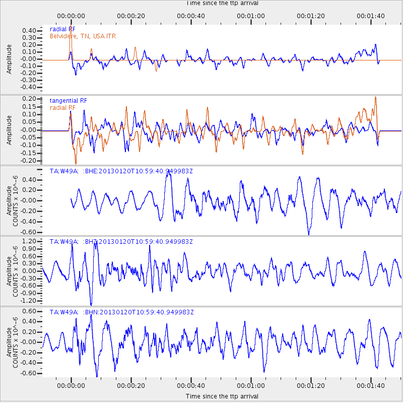
W49A Belvidere, TN, USA - Earthquake Result Viewer
*The percent match for this event was below the threshold and hence no stack was calculated.
| Earthquake location: |
Eastern Siberia, Russia |
| Earthquake latitude/longitude: |
64.8/146.5 |
| Earthquake time(UTC): |
2013/01/20 (020) 10:48:47 GMT |
| Earthquake Depth: |
12 km |
| Earthquake Magnitude: |
5.7 MB, 5.5 MS, 5.5 MW, 5.6 MW |
| Earthquake Catalog/Contributor: |
WHDF/NEIC |
|
| Network: |
TA USArray Transportable Network (new EarthScope stations) |
| Station: |
W49A Belvidere, TN, USA |
| Lat/Lon: |
35.12 N/86.26 W |
| Elevation: |
251 m |
|
| Distance: |
72.2 deg |
| Az: |
43.275 deg |
| Baz: |
339.055 deg |
| Ray Param: |
$rayparam |
*The percent match for this event was below the threshold and hence was not used in the summary stack. |
|
| Radial Match: |
54.69951 % |
| Radial Bump: |
400 |
| Transverse Match: |
67.66551 % |
| Transverse Bump: |
400 |
| SOD ConfigId: |
494114 |
| Insert Time: |
2013-04-21 00:34:17.995 +0000 |
| GWidth: |
2.5 |
| Max Bumps: |
400 |
| Tol: |
0.001 |
|
Signal To Noise
| Channel | StoN | STA | LTA |
| TA:W49A: :BHZ:20130120T10:59:40.949983Z | 1.9002417 | 5.0910967E-7 | 2.6791838E-7 |
| TA:W49A: :BHN:20130120T10:59:40.949983Z | 1.093094 | 2.0391634E-7 | 1.8654968E-7 |
| TA:W49A: :BHE:20130120T10:59:40.949983Z | 3.1003273 | 3.6640608E-7 | 1.18183046E-7 |
| Arrivals |
| Ps | |
| PpPs | |
| PsPs/PpSs | |


