You are here: Home > Network List > TA - USArray Transportable Network (new EarthScope stations) Stations List
> Station T52A Hallie, KY, USA > Earthquake Result Viewer
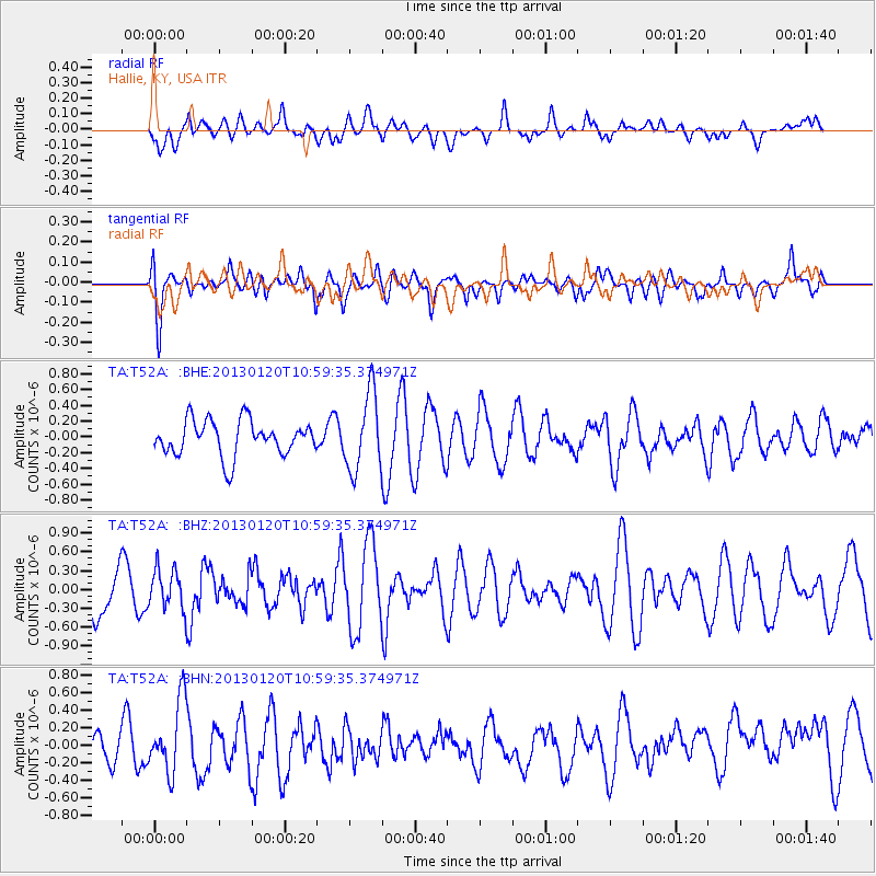
T52A Hallie, KY, USA - Earthquake Result Viewer
*The percent match for this event was below the threshold and hence no stack was calculated.
| Earthquake location: |
Eastern Siberia, Russia |
| Earthquake latitude/longitude: |
64.8/146.5 |
| Earthquake time(UTC): |
2013/01/20 (020) 10:48:47 GMT |
| Earthquake Depth: |
12 km |
| Earthquake Magnitude: |
5.7 MB, 5.5 MS, 5.5 MW, 5.6 MW |
| Earthquake Catalog/Contributor: |
WHDF/NEIC |
|
| Network: |
TA USArray Transportable Network (new EarthScope stations) |
| Station: |
T52A Hallie, KY, USA |
| Lat/Lon: |
37.11 N/82.99 W |
| Elevation: |
436 m |
|
| Distance: |
71.3 deg |
| Az: |
39.924 deg |
| Baz: |
339.929 deg |
| Ray Param: |
$rayparam |
*The percent match for this event was below the threshold and hence was not used in the summary stack. |
|
| Radial Match: |
39.649437 % |
| Radial Bump: |
400 |
| Transverse Match: |
53.940327 % |
| Transverse Bump: |
400 |
| SOD ConfigId: |
494114 |
| Insert Time: |
2013-04-21 00:34:30.256 +0000 |
| GWidth: |
2.5 |
| Max Bumps: |
400 |
| Tol: |
0.001 |
|
Signal To Noise
| Channel | StoN | STA | LTA |
| TA:T52A: :BHZ:20130120T10:59:35.374971Z | 0.7607962 | 3.128765E-7 | 4.1124878E-7 |
| TA:T52A: :BHN:20130120T10:59:35.374971Z | 2.0626974 | 4.010419E-7 | 1.9442595E-7 |
| TA:T52A: :BHE:20130120T10:59:35.374971Z | 2.2210202 | 4.881412E-7 | 2.1978242E-7 |
| Arrivals |
| Ps | |
| PpPs | |
| PsPs/PpSs | |


