You are here: Home > Network List > TA - USArray Transportable Network (new EarthScope stations) Stations List
> Station T56A Rocky Mt, VA, USA > Earthquake Result Viewer
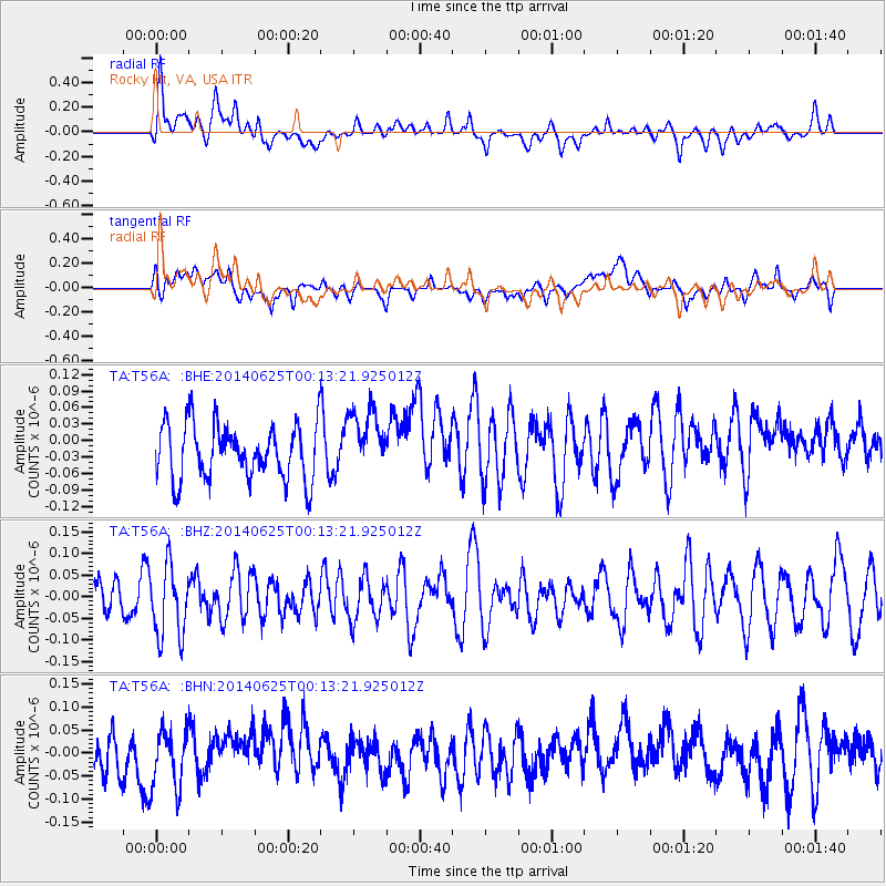
T56A Rocky Mt, VA, USA - Earthquake Result Viewer
*The percent match for this event was below the threshold and hence no stack was calculated.
| Earthquake location: |
Rat Islands, Aleutian Islands |
| Earthquake latitude/longitude: |
52.0/178.5 |
| Earthquake time(UTC): |
2014/06/25 (176) 00:03:05 GMT |
| Earthquake Depth: |
116 km |
| Earthquake Magnitude: |
5.1 MW |
| Earthquake Catalog/Contributor: |
ISC/ISC |
|
| Network: |
TA USArray Transportable Network (new EarthScope stations) |
| Station: |
T56A Rocky Mt, VA, USA |
| Lat/Lon: |
37.03 N/80.03 W |
| Elevation: |
387 m |
|
| Distance: |
68.1 deg |
| Az: |
57.695 deg |
| Baz: |
319.205 deg |
| Ray Param: |
$rayparam |
*The percent match for this event was below the threshold and hence was not used in the summary stack. |
|
| Radial Match: |
58.038918 % |
| Radial Bump: |
400 |
| Transverse Match: |
51.41081 % |
| Transverse Bump: |
400 |
| SOD ConfigId: |
3390531 |
| Insert Time: |
2019-04-12 13:11:57.223 +0000 |
| GWidth: |
2.5 |
| Max Bumps: |
400 |
| Tol: |
0.001 |
|
Signal To Noise
| Channel | StoN | STA | LTA |
| TA:T56A: :BHZ:20140625T00:13:21.925012Z | 1.3233424 | 8.291733E-8 | 6.2657506E-8 |
| TA:T56A: :BHN:20140625T00:13:21.925012Z | 1.53159 | 6.099828E-8 | 3.982677E-8 |
| TA:T56A: :BHE:20140625T00:13:21.925012Z | 1.1891459 | 5.906156E-8 | 4.966721E-8 |
| Arrivals |
| Ps | |
| PpPs | |
| PsPs/PpSs | |


