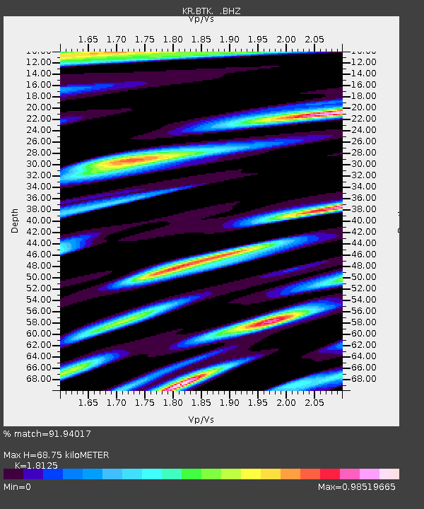
BTK Batken, Kyrgyzstan - Earthquake Result Viewer

Earthquake location: Northern Sumatra, Indonesia
Earthquake latitude/longitude: 4.9/95.9
Earthquake time(UTC): 2013/01/21 (021) 22:22:52 GMT
Earthquake Depth: 12 km
Earthquake Magnitude: 5.8 MB, 6.0 MS, 6.1 MW, 6.0 MW
Earthquake Catalog/Contributor: WHDF/NEIC
Network: KR Kyrgyz Digital Network
Station: BTK Batken, Kyrgyzstan
Lat/Lon: 40.06 N/70.82 E
Elevation: 980 m
Distance: 41.6 deg
Az: 330.68 deg
Baz: 140.528 deg
Ray Param: 0.073655024
Estimated Moho Depth: 68.75 km
Estimated Crust Vp/Vs: 1.81
Assumed Crust Vp: 6.236 km/s
Estimated Crust Vs: 3.44 km/s
Estimated Crust Poisson's Ratio: 0.28
Radial Match: 91.94017 %
Radial Bump: 400
Transverse Match: 87.176796 %
Transverse Bump: 400
SOD ConfigId: 494114
Insert Time: 2013-04-21 00:46:37.168 +0000
GWidth: 2.5
Max Bumps: 400
Tol: 0.001

Signal To Noise

ChannelStoNSTALTA
KR:BTK: :BHZ:20130121T22:30:09.974996Z4.5617384.9803515E-71.09176625E-7
KR:BTK: :BHN:20130121T22:30:09.974996Z2.13432882.1207059E-79.936171E-8
KR:BTK: :BHE:20130121T22:30:09.974996Z1.2271779.5182465E-87.7562134E-8
Arrivals
Ps9.5 SECOND
PpPs29 SECOND
PsPs/PpSs39 SECOND