You are here: Home > Network List > CI - Caltech Regional Seismic Network Stations List
> Station DAN Danby, California, USA > Earthquake Result Viewer
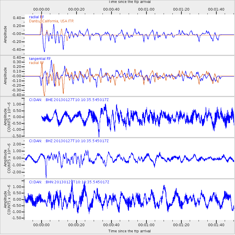
DAN Danby, California, USA - Earthquake Result Viewer
*The percent match for this event was below the threshold and hence no stack was calculated.
| Earthquake location: |
Tonga Islands |
| Earthquake latitude/longitude: |
-16.1/-173.2 |
| Earthquake time(UTC): |
2013/01/27 (027) 09:59:29 GMT |
| Earthquake Depth: |
19 km |
| Earthquake Magnitude: |
5.7 MB, 5.5 MS, 5.7 MW, 5.7 MW |
| Earthquake Catalog/Contributor: |
WHDF/NEIC |
|
| Network: |
CI Caltech Regional Seismic Network |
| Station: |
DAN Danby, California, USA |
| Lat/Lon: |
34.64 N/115.38 W |
| Elevation: |
398 m |
|
| Distance: |
74.6 deg |
| Az: |
46.398 deg |
| Baz: |
237.582 deg |
| Ray Param: |
$rayparam |
*The percent match for this event was below the threshold and hence was not used in the summary stack. |
|
| Radial Match: |
62.216644 % |
| Radial Bump: |
400 |
| Transverse Match: |
59.627647 % |
| Transverse Bump: |
400 |
| SOD ConfigId: |
494114 |
| Insert Time: |
2013-04-24 03:38:55.803 +0000 |
| GWidth: |
2.5 |
| Max Bumps: |
400 |
| Tol: |
0.001 |
|
Signal To Noise
| Channel | StoN | STA | LTA |
| CI:DAN: :BHZ:20130127T10:10:35.545017Z | 3.6290908 | 8.4470656E-7 | 2.3275983E-7 |
| CI:DAN: :BHN:20130127T10:10:35.545017Z | 1.2838831 | 2.6112144E-7 | 2.0338412E-7 |
| CI:DAN: :BHE:20130127T10:10:35.545017Z | 1.9360294 | 5.247944E-7 | 2.7106736E-7 |
| Arrivals |
| Ps | |
| PpPs | |
| PsPs/PpSs | |


