You are here: Home > Network List > CI - Caltech Regional Seismic Network Stations List
> Station MUR Murrieta > Earthquake Result Viewer
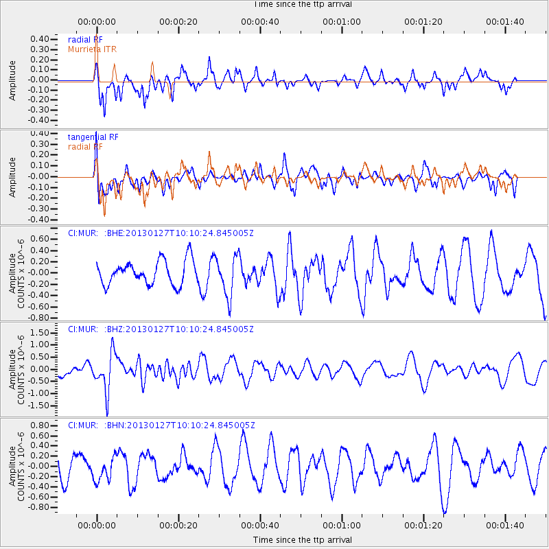
MUR Murrieta - Earthquake Result Viewer
*The percent match for this event was below the threshold and hence no stack was calculated.
| Earthquake location: |
Tonga Islands |
| Earthquake latitude/longitude: |
-16.1/-173.2 |
| Earthquake time(UTC): |
2013/01/27 (027) 09:59:29 GMT |
| Earthquake Depth: |
19 km |
| Earthquake Magnitude: |
5.7 MB, 5.5 MS, 5.7 MW, 5.7 MW |
| Earthquake Catalog/Contributor: |
WHDF/NEIC |
|
| Network: |
CI Caltech Regional Seismic Network |
| Station: |
MUR Murrieta |
| Lat/Lon: |
33.60 N/117.20 W |
| Elevation: |
562 m |
|
| Distance: |
72.8 deg |
| Az: |
46.451 deg |
| Baz: |
236.583 deg |
| Ray Param: |
$rayparam |
*The percent match for this event was below the threshold and hence was not used in the summary stack. |
|
| Radial Match: |
66.163574 % |
| Radial Bump: |
341 |
| Transverse Match: |
52.041714 % |
| Transverse Bump: |
400 |
| SOD ConfigId: |
494114 |
| Insert Time: |
2013-04-24 03:40:18.040 +0000 |
| GWidth: |
2.5 |
| Max Bumps: |
400 |
| Tol: |
0.001 |
|
Signal To Noise
| Channel | StoN | STA | LTA |
| CI:MUR: :BHZ:20130127T10:10:24.845005Z | 2.6615713 | 7.9583305E-7 | 2.9900875E-7 |
| CI:MUR: :BHN:20130127T10:10:24.845005Z | 0.6276939 | 2.3830587E-7 | 3.7965302E-7 |
| CI:MUR: :BHE:20130127T10:10:24.845005Z | 1.716079 | 3.6225939E-7 | 2.1109715E-7 |
| Arrivals |
| Ps | |
| PpPs | |
| PsPs/PpSs | |


