You are here: Home > Network List > CN - Canadian National Seismograph Network Stations List
> Station INK INUVIK, NT > Earthquake Result Viewer
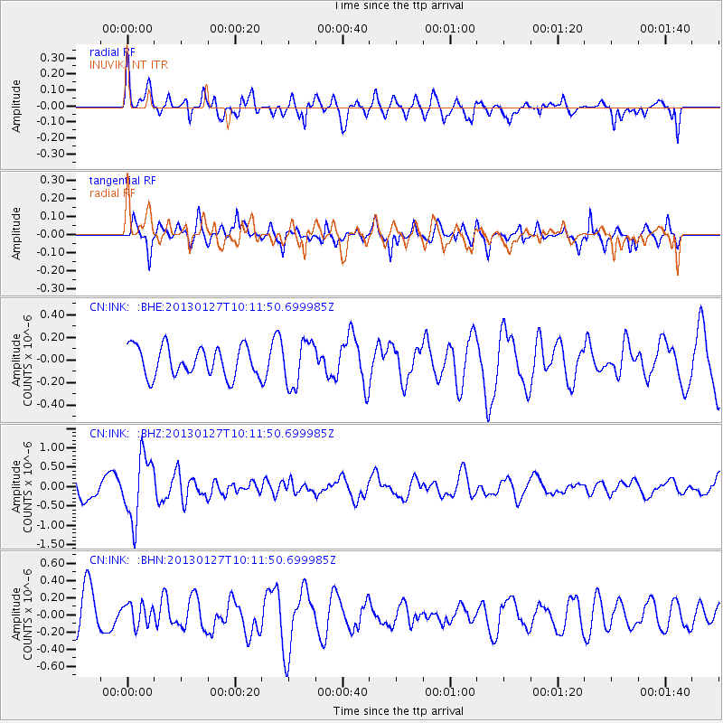
INK INUVIK, NT - Earthquake Result Viewer
*The percent match for this event was below the threshold and hence no stack was calculated.
| Earthquake location: |
Tonga Islands |
| Earthquake latitude/longitude: |
-16.1/-173.2 |
| Earthquake time(UTC): |
2013/01/27 (027) 09:59:29 GMT |
| Earthquake Depth: |
19 km |
| Earthquake Magnitude: |
5.7 MB, 5.5 MS, 5.7 MW, 5.7 MW |
| Earthquake Catalog/Contributor: |
WHDF/NEIC |
|
| Network: |
CN Canadian National Seismograph Network |
| Station: |
INK INUVIK, NT |
| Lat/Lon: |
68.31 N/133.53 W |
| Elevation: |
44 m |
|
| Distance: |
88.9 deg |
| Az: |
13.744 deg |
| Baz: |
217.895 deg |
| Ray Param: |
$rayparam |
*The percent match for this event was below the threshold and hence was not used in the summary stack. |
|
| Radial Match: |
61.493057 % |
| Radial Bump: |
400 |
| Transverse Match: |
67.198425 % |
| Transverse Bump: |
400 |
| SOD ConfigId: |
494114 |
| Insert Time: |
2013-04-24 03:40:36.607 +0000 |
| GWidth: |
2.5 |
| Max Bumps: |
400 |
| Tol: |
0.001 |
|
Signal To Noise
| Channel | StoN | STA | LTA |
| CN:INK: :BHZ:20130127T10:11:50.699985Z | 2.5757015 | 8.2491533E-7 | 3.2026824E-7 |
| CN:INK: :BHN:20130127T10:11:50.699985Z | 0.5435229 | 1.3043282E-7 | 2.3997669E-7 |
| CN:INK: :BHE:20130127T10:11:50.699985Z | 1.5098587 | 1.9782709E-7 | 1.3102357E-7 |
| Arrivals |
| Ps | |
| PpPs | |
| PsPs/PpSs | |


