You are here: Home > Network List > IW - Intermountain West Stations List
> Station PLID Pearl Lake, Idaho, USA > Earthquake Result Viewer
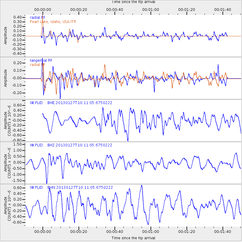
PLID Pearl Lake, Idaho, USA - Earthquake Result Viewer
*The percent match for this event was below the threshold and hence no stack was calculated.
| Earthquake location: |
Tonga Islands |
| Earthquake latitude/longitude: |
-16.1/-173.2 |
| Earthquake time(UTC): |
2013/01/27 (027) 09:59:29 GMT |
| Earthquake Depth: |
19 km |
| Earthquake Magnitude: |
5.7 MB, 5.5 MS, 5.7 MW, 5.7 MW |
| Earthquake Catalog/Contributor: |
WHDF/NEIC |
|
| Network: |
IW Intermountain West |
| Station: |
PLID Pearl Lake, Idaho, USA |
| Lat/Lon: |
45.09 N/116.00 W |
| Elevation: |
2164 m |
|
| Distance: |
80.0 deg |
| Az: |
37.221 deg |
| Baz: |
235.16 deg |
| Ray Param: |
$rayparam |
*The percent match for this event was below the threshold and hence was not used in the summary stack. |
|
| Radial Match: |
62.580925 % |
| Radial Bump: |
400 |
| Transverse Match: |
65.09669 % |
| Transverse Bump: |
400 |
| SOD ConfigId: |
494114 |
| Insert Time: |
2013-04-24 03:42:57.181 +0000 |
| GWidth: |
2.5 |
| Max Bumps: |
400 |
| Tol: |
0.001 |
|
Signal To Noise
| Channel | StoN | STA | LTA |
| IW:PLID: :BHZ:20130127T10:11:05.675022Z | 1.7205054 | 6.8818156E-7 | 3.9998804E-7 |
| IW:PLID: :BHN:20130127T10:11:05.675022Z | 1.2348471 | 3.008108E-7 | 2.4360165E-7 |
| IW:PLID: :BHE:20130127T10:11:05.675022Z | 1.3292558 | 2.4394726E-7 | 1.8352169E-7 |
| Arrivals |
| Ps | |
| PpPs | |
| PsPs/PpSs | |


