You are here: Home > Network List > TA - USArray Transportable Network (new EarthScope stations) Stations List
> Station T41A Mountain View, MO, USA > Earthquake Result Viewer
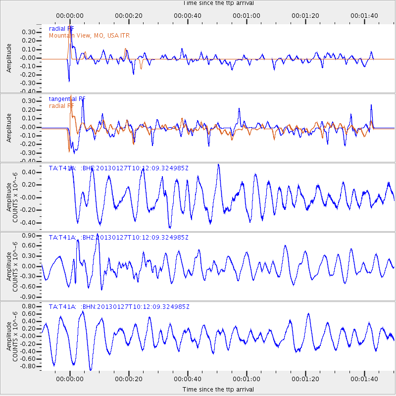
T41A Mountain View, MO, USA - Earthquake Result Viewer
*The percent match for this event was below the threshold and hence no stack was calculated.
| Earthquake location: |
Tonga Islands |
| Earthquake latitude/longitude: |
-16.1/-173.2 |
| Earthquake time(UTC): |
2013/01/27 (027) 09:59:29 GMT |
| Earthquake Depth: |
19 km |
| Earthquake Magnitude: |
5.7 MB, 5.5 MS, 5.7 MW, 5.7 MW |
| Earthquake Catalog/Contributor: |
WHDF/NEIC |
|
| Network: |
TA USArray Transportable Network (new EarthScope stations) |
| Station: |
T41A Mountain View, MO, USA |
| Lat/Lon: |
37.04 N/91.76 W |
| Elevation: |
366 m |
|
| Distance: |
92.9 deg |
| Az: |
52.403 deg |
| Baz: |
252.142 deg |
| Ray Param: |
$rayparam |
*The percent match for this event was below the threshold and hence was not used in the summary stack. |
|
| Radial Match: |
57.730705 % |
| Radial Bump: |
400 |
| Transverse Match: |
69.19736 % |
| Transverse Bump: |
400 |
| SOD ConfigId: |
494114 |
| Insert Time: |
2013-04-24 03:46:52.231 +0000 |
| GWidth: |
2.5 |
| Max Bumps: |
400 |
| Tol: |
0.001 |
|
Signal To Noise
| Channel | StoN | STA | LTA |
| TA:T41A: :BHZ:20130127T10:12:09.324985Z | 2.5587919 | 4.0847905E-7 | 1.5963747E-7 |
| TA:T41A: :BHN:20130127T10:12:09.324985Z | 2.4793937 | 5.1068275E-7 | 2.0597082E-7 |
| TA:T41A: :BHE:20130127T10:12:09.324985Z | 1.0008899 | 2.4494648E-7 | 2.4472868E-7 |
| Arrivals |
| Ps | |
| PpPs | |
| PsPs/PpSs | |


