You are here: Home > Network List > TA - USArray Transportable Network (new EarthScope stations) Stations List
> Station Y50A Piedmont, AL, USA > Earthquake Result Viewer
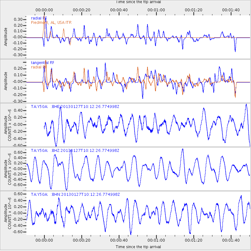
Y50A Piedmont, AL, USA - Earthquake Result Viewer
*The percent match for this event was below the threshold and hence no stack was calculated.
| Earthquake location: |
Tonga Islands |
| Earthquake latitude/longitude: |
-16.1/-173.2 |
| Earthquake time(UTC): |
2013/01/27 (027) 09:59:29 GMT |
| Earthquake Depth: |
19 km |
| Earthquake Magnitude: |
5.7 MB, 5.5 MS, 5.7 MW, 5.7 MW |
| Earthquake Catalog/Contributor: |
WHDF/NEIC |
|
| Network: |
TA USArray Transportable Network (new EarthScope stations) |
| Station: |
Y50A Piedmont, AL, USA |
| Lat/Lon: |
33.89 N/85.73 W |
| Elevation: |
248 m |
|
| Distance: |
96.8 deg |
| Az: |
56.815 deg |
| Baz: |
255.254 deg |
| Ray Param: |
$rayparam |
*The percent match for this event was below the threshold and hence was not used in the summary stack. |
|
| Radial Match: |
61.18844 % |
| Radial Bump: |
400 |
| Transverse Match: |
50.60888 % |
| Transverse Bump: |
400 |
| SOD ConfigId: |
494114 |
| Insert Time: |
2013-04-24 03:47:53.645 +0000 |
| GWidth: |
2.5 |
| Max Bumps: |
400 |
| Tol: |
0.001 |
|
Signal To Noise
| Channel | StoN | STA | LTA |
| TA:Y50A: :BHZ:20130127T10:12:26.774998Z | 1.1837074 | 3.6778735E-7 | 3.1070797E-7 |
| TA:Y50A: :BHN:20130127T10:12:26.774998Z | 0.64412063 | 1.753028E-7 | 2.7215833E-7 |
| TA:Y50A: :BHE:20130127T10:12:26.774998Z | 0.75553626 | 1.7991076E-7 | 2.3812326E-7 |
| Arrivals |
| Ps | |
| PpPs | |
| PsPs/PpSs | |


