You are here: Home > Network List > TA - USArray Transportable Network (new EarthScope stations) Stations List
> Station P47A Martinsville, IN, USA > Earthquake Result Viewer
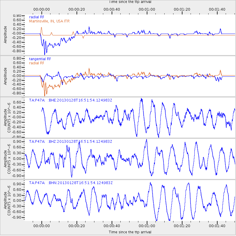
P47A Martinsville, IN, USA - Earthquake Result Viewer
*The percent match for this event was below the threshold and hence no stack was calculated.
| Earthquake location: |
Lake Issyk-Kul Region |
| Earthquake latitude/longitude: |
42.6/79.7 |
| Earthquake time(UTC): |
2013/01/28 (028) 16:38:53 GMT |
| Earthquake Depth: |
15 km |
| Earthquake Magnitude: |
6.1 MB, 6.2 MS, 6.1 MW, 6.1 MW |
| Earthquake Catalog/Contributor: |
WHDF/NEIC |
|
| Network: |
TA USArray Transportable Network (new EarthScope stations) |
| Station: |
P47A Martinsville, IN, USA |
| Lat/Lon: |
39.49 N/86.27 W |
| Elevation: |
246 m |
|
| Distance: |
97.3 deg |
| Az: |
349.103 deg |
| Baz: |
10.391 deg |
| Ray Param: |
$rayparam |
*The percent match for this event was below the threshold and hence was not used in the summary stack. |
|
| Radial Match: |
73.73202 % |
| Radial Bump: |
400 |
| Transverse Match: |
59.63924 % |
| Transverse Bump: |
400 |
| SOD ConfigId: |
494114 |
| Insert Time: |
2013-04-24 03:58:18.143 +0000 |
| GWidth: |
2.5 |
| Max Bumps: |
400 |
| Tol: |
0.001 |
|
Signal To Noise
| Channel | StoN | STA | LTA |
| TA:P47A: :BHZ:20130128T16:51:54.124983Z | 0.7115525 | 2.3674835E-7 | 3.3272084E-7 |
| TA:P47A: :BHN:20130128T16:51:54.124983Z | 1.0434445 | 4.6747283E-7 | 4.4800925E-7 |
| TA:P47A: :BHE:20130128T16:51:54.124983Z | 0.43046772 | 1.0998258E-7 | 2.5549554E-7 |
| Arrivals |
| Ps | |
| PpPs | |
| PsPs/PpSs | |


