You are here: Home > Network List > TA - USArray Transportable Network (new EarthScope stations) Stations List
> Station N49A Columbus Grove, OH, USA > Earthquake Result Viewer
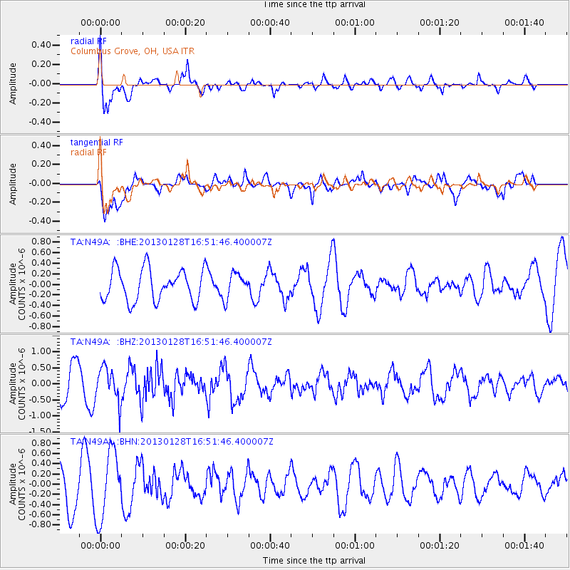
N49A Columbus Grove, OH, USA - Earthquake Result Viewer
*The percent match for this event was below the threshold and hence no stack was calculated.
| Earthquake location: |
Lake Issyk-Kul Region |
| Earthquake latitude/longitude: |
42.6/79.7 |
| Earthquake time(UTC): |
2013/01/28 (028) 16:38:53 GMT |
| Earthquake Depth: |
15 km |
| Earthquake Magnitude: |
6.1 MB, 6.2 MS, 6.1 MW, 6.1 MW |
| Earthquake Catalog/Contributor: |
WHDF/NEIC |
|
| Network: |
TA USArray Transportable Network (new EarthScope stations) |
| Station: |
N49A Columbus Grove, OH, USA |
| Lat/Lon: |
40.92 N/84.18 W |
| Elevation: |
225 m |
|
| Distance: |
95.6 deg |
| Az: |
347.803 deg |
| Baz: |
11.879 deg |
| Ray Param: |
$rayparam |
*The percent match for this event was below the threshold and hence was not used in the summary stack. |
|
| Radial Match: |
71.6824 % |
| Radial Bump: |
400 |
| Transverse Match: |
55.99464 % |
| Transverse Bump: |
400 |
| SOD ConfigId: |
494114 |
| Insert Time: |
2013-04-24 03:58:47.467 +0000 |
| GWidth: |
2.5 |
| Max Bumps: |
400 |
| Tol: |
0.001 |
|
Signal To Noise
| Channel | StoN | STA | LTA |
| TA:N49A: :BHZ:20130128T16:51:46.400007Z | 1.123991 | 5.2362793E-7 | 4.6586487E-7 |
| TA:N49A: :BHN:20130128T16:51:46.400007Z | 2.0343516 | 6.663757E-7 | 3.275617E-7 |
| TA:N49A: :BHE:20130128T16:51:46.400007Z | 0.8068444 | 2.4163404E-7 | 2.9948032E-7 |
| Arrivals |
| Ps | |
| PpPs | |
| PsPs/PpSs | |


