You are here: Home > Network List > TA - USArray Transportable Network (new EarthScope stations) Stations List
> Station 151A Opelika, AL, USA > Earthquake Result Viewer
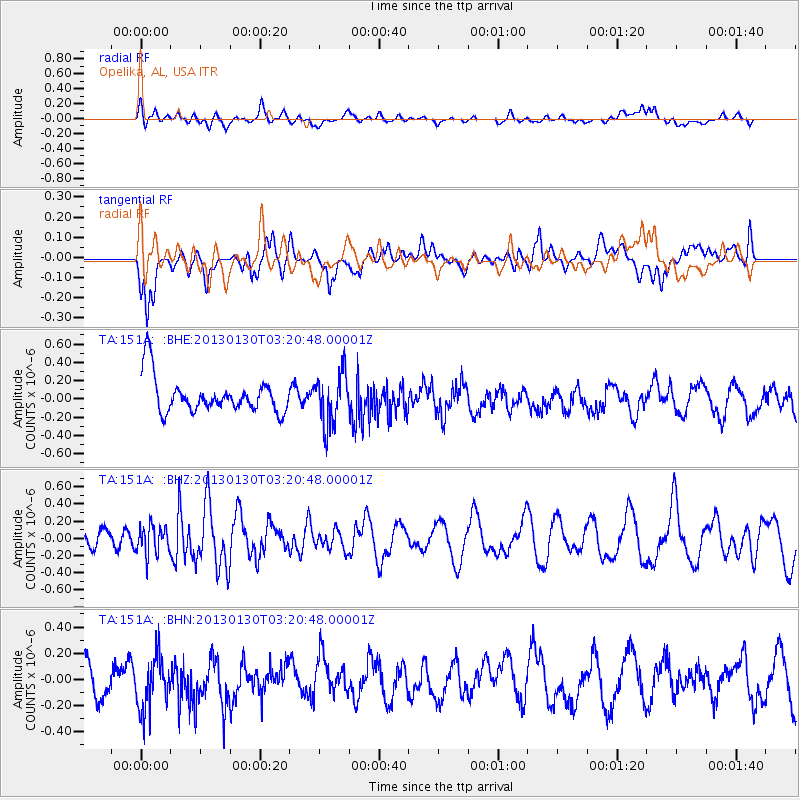
151A Opelika, AL, USA - Earthquake Result Viewer
*The percent match for this event was below the threshold and hence no stack was calculated.
| Earthquake location: |
Off Coast Of Oregon |
| Earthquake latitude/longitude: |
43.6/-127.6 |
| Earthquake time(UTC): |
2013/01/30 (030) 03:14:28 GMT |
| Earthquake Depth: |
10 km |
| Earthquake Magnitude: |
5.6 MB, 5.4 MW, 5.4 MW |
| Earthquake Catalog/Contributor: |
WHDF/NEIC |
|
| Network: |
TA USArray Transportable Network (new EarthScope stations) |
| Station: |
151A Opelika, AL, USA |
| Lat/Lon: |
32.53 N/85.33 W |
| Elevation: |
211 m |
|
| Distance: |
34.7 deg |
| Az: |
94.145 deg |
| Baz: |
300.998 deg |
| Ray Param: |
$rayparam |
*The percent match for this event was below the threshold and hence was not used in the summary stack. |
|
| Radial Match: |
40.66491 % |
| Radial Bump: |
400 |
| Transverse Match: |
60.52142 % |
| Transverse Bump: |
400 |
| SOD ConfigId: |
494114 |
| Insert Time: |
2013-04-27 03:29:08.237 +0000 |
| GWidth: |
2.5 |
| Max Bumps: |
400 |
| Tol: |
0.001 |
|
Signal To Noise
| Channel | StoN | STA | LTA |
| TA:151A: :BHZ:20130130T03:20:48.00001Z | 0.9557943 | 1.654904E-7 | 1.7314439E-7 |
| TA:151A: :BHN:20130130T03:20:48.00001Z | 1.5260745 | 2.0894807E-7 | 1.3691866E-7 |
| TA:151A: :BHE:20130130T03:20:48.00001Z | 1.477066 | 2.8421778E-7 | 1.924205E-7 |
| Arrivals |
| Ps | |
| PpPs | |
| PsPs/PpSs | |


