You are here: Home > Network List > TA - USArray Transportable Network (new EarthScope stations) Stations List
> Station K40A Colesburg, IA, USA > Earthquake Result Viewer
K40A Colesburg, IA, USA - Earthquake Result Viewer

| Earthquake location: |
Central Chile |
| Earthquake latitude/longitude: |
-28.1/-70.7 |
| Earthquake time(UTC): |
2013/01/30 (030) 20:15:43 GMT |
| Earthquake Depth: |
45 km |
| Earthquake Magnitude: |
6.5 MB, 6.5 MS, 6.8 MW, 6.8 MW |
| Earthquake Catalog/Contributor: |
WHDF/NEIC |
|
| Network: |
TA USArray Transportable Network (new EarthScope stations) |
| Station: |
K40A Colesburg, IA, USA |
| Lat/Lon: |
42.70 N/91.14 W |
| Elevation: |
274 m |
|
| Distance: |
72.9 deg |
| Az: |
344.343 deg |
| Baz: |
161.129 deg |
| Ray Param: |
0.053258114 |
| Estimated Moho Depth: |
48.5 km |
| Estimated Crust Vp/Vs: |
1.70 |
| Assumed Crust Vp: |
6.53 km/s |
| Estimated Crust Vs: |
3.847 km/s |
| Estimated Crust Poisson's Ratio: |
0.23 |
|
| Radial Match: |
96.27467 % |
| Radial Bump: |
400 |
| Transverse Match: |
85.46374 % |
| Transverse Bump: |
400 |
| SOD ConfigId: |
494114 |
| Insert Time: |
2013-04-27 03:56:42.182 +0000 |
| GWidth: |
2.5 |
| Max Bumps: |
400 |
| Tol: |
0.001 |
|
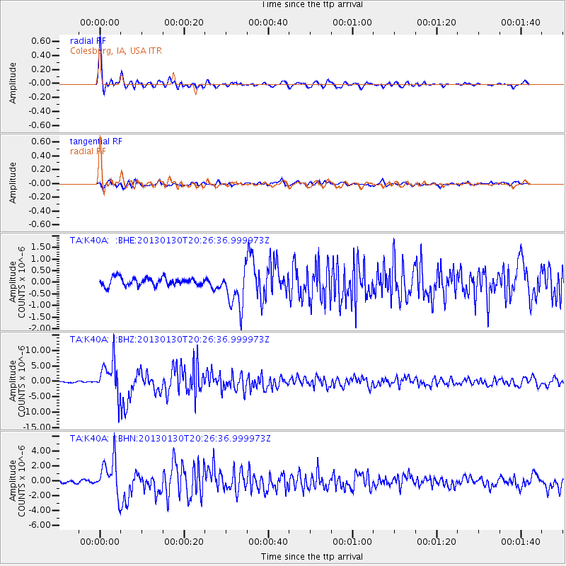
Signal To Noise
| Channel | StoN | STA | LTA |
| TA:K40A: :BHZ:20130130T20:26:36.999973Z | 39.88303 | 5.6042545E-6 | 1.4051729E-7 |
| TA:K40A: :BHN:20130130T20:26:36.999973Z | 16.802454 | 2.5099519E-6 | 1.4938007E-7 |
| TA:K40A: :BHE:20130130T20:26:36.999973Z | 5.018147 | 8.657725E-7 | 1.7252833E-7 |
| Arrivals |
| Ps | 5.4 SECOND |
| PpPs | 19 SECOND |
| PsPs/PpSs | 25 SECOND |


