You are here: Home > Network List > AV - Alaska Volcano Observatory Stations List
> Station AMKA Regional Station, Amchitka Island, Alaska > Earthquake Result Viewer
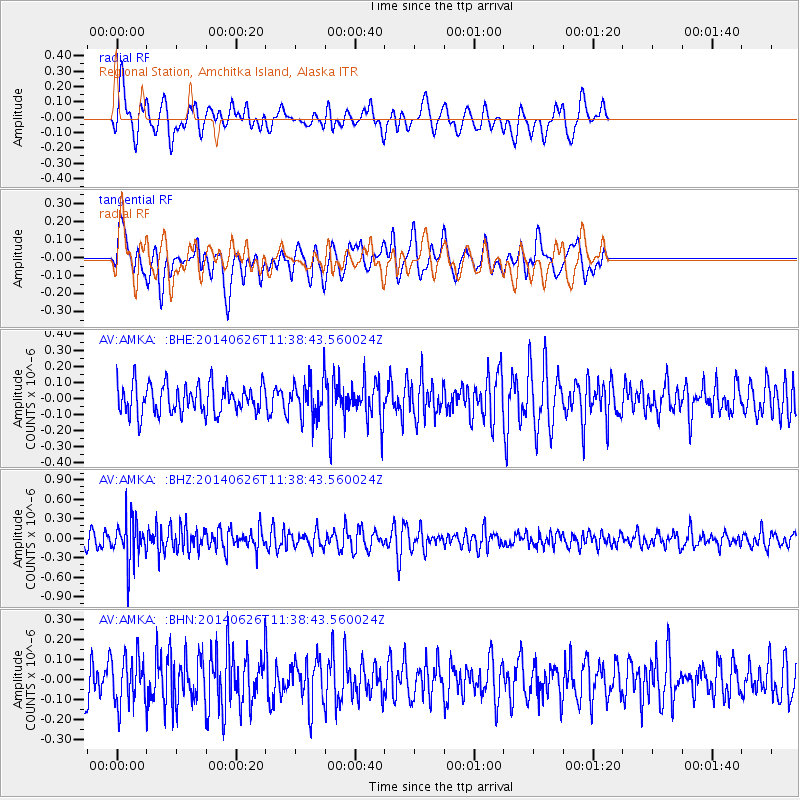
AMKA Regional Station, Amchitka Island, Alaska - Earthquake Result Viewer
*The percent match for this event was below the threshold and hence no stack was calculated.
| Earthquake location: |
Minahassa Peninsula, Sulawesi |
| Earthquake latitude/longitude: |
-0.0/123.4 |
| Earthquake time(UTC): |
2014/06/26 (177) 11:28:23 GMT |
| Earthquake Depth: |
156 km |
| Earthquake Magnitude: |
5.2 MW |
| Earthquake Catalog/Contributor: |
ISC/ISC |
|
| Network: |
AV Alaska Volcano Observatory |
| Station: |
AMKA Regional Station, Amchitka Island, Alaska |
| Lat/Lon: |
51.38 N/179.30 E |
| Elevation: |
116 m |
|
| Distance: |
69.4 deg |
| Az: |
33.665 deg |
| Baz: |
242.188 deg |
| Ray Param: |
$rayparam |
*The percent match for this event was below the threshold and hence was not used in the summary stack. |
|
| Radial Match: |
43.69066 % |
| Radial Bump: |
400 |
| Transverse Match: |
60.232067 % |
| Transverse Bump: |
400 |
| SOD ConfigId: |
3390531 |
| Insert Time: |
2019-04-12 13:39:11.224 +0000 |
| GWidth: |
2.5 |
| Max Bumps: |
400 |
| Tol: |
0.001 |
|
Signal To Noise
| Channel | StoN | STA | LTA |
| AV:AMKA: :BHZ:20140626T11:38:43.560024Z | 3.0840218 | 3.3423967E-7 | 1.08377854E-7 |
| AV:AMKA: :BHN:20140626T11:38:43.560024Z | 1.1166537 | 1.2127784E-7 | 1.0860829E-7 |
| AV:AMKA: :BHE:20140626T11:38:43.560024Z | 1.2528769 | 1.1340945E-7 | 9.051923E-8 |
| Arrivals |
| Ps | |
| PpPs | |
| PsPs/PpSs | |


