You are here: Home > Network List > TA - USArray Transportable Network (new EarthScope stations) Stations List
> Station 349A Repton, AL, USA > Earthquake Result Viewer
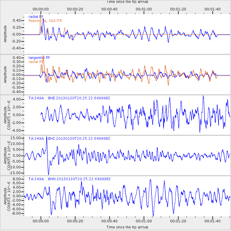
349A Repton, AL, USA - Earthquake Result Viewer
*The percent match for this event was below the threshold and hence no stack was calculated.
| Earthquake location: |
Central Chile |
| Earthquake latitude/longitude: |
-28.1/-70.7 |
| Earthquake time(UTC): |
2013/01/30 (030) 20:15:43 GMT |
| Earthquake Depth: |
45 km |
| Earthquake Magnitude: |
6.5 MB, 6.5 MS, 6.8 MW, 6.8 MW |
| Earthquake Catalog/Contributor: |
WHDF/NEIC |
|
| Network: |
TA USArray Transportable Network (new EarthScope stations) |
| Station: |
349A Repton, AL, USA |
| Lat/Lon: |
31.35 N/87.19 W |
| Elevation: |
88 m |
|
| Distance: |
61.2 deg |
| Az: |
343.86 deg |
| Baz: |
163.318 deg |
| Ray Param: |
$rayparam |
*The percent match for this event was below the threshold and hence was not used in the summary stack. |
|
| Radial Match: |
78.534584 % |
| Radial Bump: |
351 |
| Transverse Match: |
76.70093 % |
| Transverse Bump: |
343 |
| SOD ConfigId: |
494114 |
| Insert Time: |
2013-04-27 04:07:08.148 +0000 |
| GWidth: |
2.5 |
| Max Bumps: |
400 |
| Tol: |
0.001 |
|
Signal To Noise
| Channel | StoN | STA | LTA |
| TA:349A: :BHZ:20130130T20:25:22.649998Z | 5.6629124 | 7.4386803E-6 | 1.3135785E-6 |
| TA:349A: :BHN:20130130T20:25:22.649998Z | 1.5420442 | 2.1365786E-6 | 1.3855496E-6 |
| TA:349A: :BHE:20130130T20:25:22.649998Z | 0.60457414 | 6.2597354E-7 | 1.0353958E-6 |
| Arrivals |
| Ps | |
| PpPs | |
| PsPs/PpSs | |


