You are here: Home > Network List > CN - Canadian National Seismograph Network Stations List
> Station INK INUVIK, NT > Earthquake Result Viewer
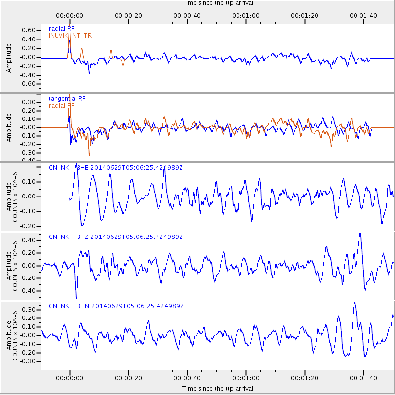
INK INUVIK, NT - Earthquake Result Viewer
*The percent match for this event was below the threshold and hence no stack was calculated.
| Earthquake location: |
Eastern Arizona |
| Earthquake latitude/longitude: |
32.6/-109.1 |
| Earthquake time(UTC): |
2014/06/29 (180) 04:59:34 GMT |
| Earthquake Depth: |
12 km |
| Earthquake Magnitude: |
5.3 MW |
| Earthquake Catalog/Contributor: |
ISC/ISC |
|
| Network: |
CN Canadian National Seismograph Network |
| Station: |
INK INUVIK, NT |
| Lat/Lon: |
68.31 N/133.53 W |
| Elevation: |
44 m |
|
| Distance: |
38.4 deg |
| Az: |
345.671 deg |
| Baz: |
145.809 deg |
| Ray Param: |
$rayparam |
*The percent match for this event was below the threshold and hence was not used in the summary stack. |
|
| Radial Match: |
57.22403 % |
| Radial Bump: |
400 |
| Transverse Match: |
50.827633 % |
| Transverse Bump: |
400 |
| SOD ConfigId: |
3390531 |
| Insert Time: |
2019-04-12 13:49:00.520 +0000 |
| GWidth: |
2.5 |
| Max Bumps: |
400 |
| Tol: |
0.001 |
|
Signal To Noise
| Channel | StoN | STA | LTA |
| CN:INK: :BHZ:20140629T05:06:25.424989Z | 3.6256256 | 1.902167E-7 | 5.2464518E-8 |
| CN:INK: :BHN:20140629T05:06:25.424989Z | 3.328549 | 9.88732E-8 | 2.9704596E-8 |
| CN:INK: :BHE:20140629T05:06:25.424989Z | 0.83695316 | 8.43075E-8 | 1.0073144E-7 |
| Arrivals |
| Ps | |
| PpPs | |
| PsPs/PpSs | |


