You are here: Home > Network List > GE - GEOFON Stations List
> Station UGM GEOFON Station Wanagama, Indonesia > Earthquake Result Viewer
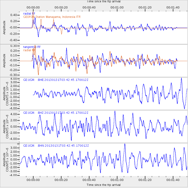
UGM GEOFON Station Wanagama, Indonesia - Earthquake Result Viewer
*The percent match for this event was below the threshold and hence no stack was calculated.
| Earthquake location: |
Santa Cruz Islands |
| Earthquake latitude/longitude: |
-10.6/166.4 |
| Earthquake time(UTC): |
2013/01/31 (031) 03:33:43 GMT |
| Earthquake Depth: |
9.0 km |
| Earthquake Magnitude: |
6.1 MB, 6.1 MS, 6.1 MW, 6.0 MW |
| Earthquake Catalog/Contributor: |
WHDF/NEIC |
|
| Network: |
GE GEOFON |
| Station: |
UGM GEOFON Station Wanagama, Indonesia |
| Lat/Lon: |
7.91 S/110.52 E |
| Elevation: |
350 m |
|
| Distance: |
55.1 deg |
| Az: |
267.736 deg |
| Baz: |
97.441 deg |
| Ray Param: |
$rayparam |
*The percent match for this event was below the threshold and hence was not used in the summary stack. |
|
| Radial Match: |
80.17758 % |
| Radial Bump: |
400 |
| Transverse Match: |
72.12196 % |
| Transverse Bump: |
400 |
| SOD ConfigId: |
494114 |
| Insert Time: |
2013-04-27 04:42:40.421 +0000 |
| GWidth: |
2.5 |
| Max Bumps: |
400 |
| Tol: |
0.001 |
|
Signal To Noise
| Channel | StoN | STA | LTA |
| GE:UGM: :BHZ:20130131T03:42:45.170012Z | 2.2509878 | 1.640261E-6 | 7.28685E-7 |
| GE:UGM: :BHN:20130131T03:42:45.170012Z | 0.8095237 | 5.9676535E-7 | 7.3718087E-7 |
| GE:UGM: :BHE:20130131T03:42:45.170012Z | 1.2272397 | 6.412921E-7 | 5.2254836E-7 |
| Arrivals |
| Ps | |
| PpPs | |
| PsPs/PpSs | |


