You are here: Home > Network List > GT - Global Telemetered Seismograph Network (USAF/USGS) Stations List
> Station BDFB Brasilia, Brazil > Earthquake Result Viewer
BDFB Brasilia, Brazil - Earthquake Result Viewer

| Earthquake location: |
Chiapas, Mexico |
| Earthquake latitude/longitude: |
16.9/-93.5 |
| Earthquake time(UTC): |
1995/10/21 (294) 02:38:57 GMT |
| Earthquake Depth: |
161 km |
| Earthquake Magnitude: |
6.2 MB, 7.3 UNKNOWN, 7.3 MW |
| Earthquake Catalog/Contributor: |
WHDF/NEIC |
|
| Network: |
GT Global Telemetered Seismograph Network (USAF/USGS) |
| Station: |
BDFB Brasilia, Brazil |
| Lat/Lon: |
15.64 S/48.01 W |
| Elevation: |
1195 m |
|
| Distance: |
55.3 deg |
| Az: |
123.35 deg |
| Baz: |
303.891 deg |
| Ray Param: |
0.064380325 |
| Estimated Moho Depth: |
42.5 km |
| Estimated Crust Vp/Vs: |
1.67 |
| Assumed Crust Vp: |
6.419 km/s |
| Estimated Crust Vs: |
3.85 km/s |
| Estimated Crust Poisson's Ratio: |
0.22 |
|
| Radial Match: |
96.235374 % |
| Radial Bump: |
377 |
| Transverse Match: |
85.494774 % |
| Transverse Bump: |
400 |
| SOD ConfigId: |
6273 |
| Insert Time: |
2010-02-27 01:35:18.798 +0000 |
| GWidth: |
2.5 |
| Max Bumps: |
400 |
| Tol: |
0.001 |
|
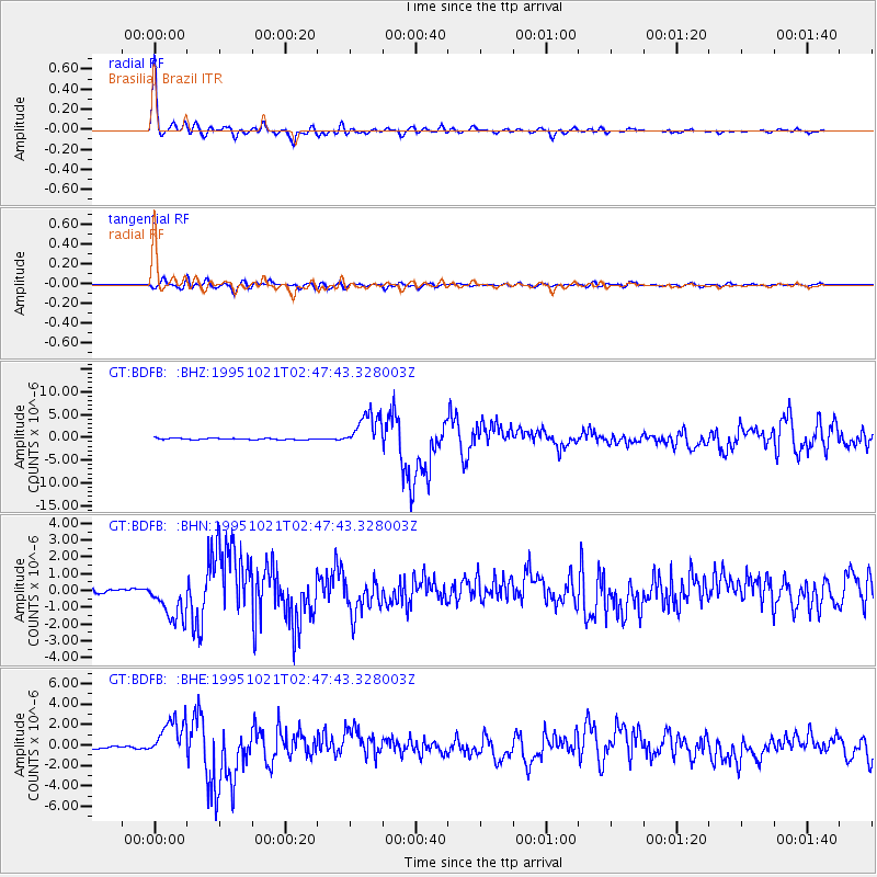
Signal To Noise
| Channel | StoN | STA | LTA |
| GT:BDFB: :BHN:19951021T02:47:43.328003Z | 11.238036 | 1.2210512E-6 | 1.0865344E-7 |
| GT:BDFB: :BHE:19951021T02:47:43.328003Z | 14.524711 | 1.8941017E-6 | 1.3040547E-7 |
| GT:BDFB: :BHZ:19951021T02:47:43.328003Z | 25.539158 | 3.835423E-6 | 1.5017814E-7 |
| Arrivals |
| Ps | 4.7 SECOND |
| PpPs | 17 SECOND |
| PsPs/PpSs | 21 SECOND |


