You are here: Home > Network List > TA - USArray Transportable Network (new EarthScope stations) Stations List
> Station G60A Masonville, QC, CAN > Earthquake Result Viewer
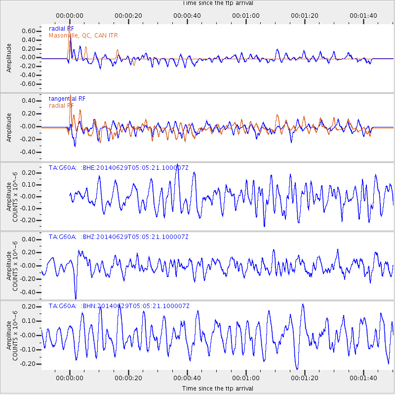
G60A Masonville, QC, CAN - Earthquake Result Viewer
*The percent match for this event was below the threshold and hence no stack was calculated.
| Earthquake location: |
Eastern Arizona |
| Earthquake latitude/longitude: |
32.6/-109.1 |
| Earthquake time(UTC): |
2014/06/29 (180) 04:59:34 GMT |
| Earthquake Depth: |
12 km |
| Earthquake Magnitude: |
5.3 MW |
| Earthquake Catalog/Contributor: |
ISC/ISC |
|
| Network: |
TA USArray Transportable Network (new EarthScope stations) |
| Station: |
G60A Masonville, QC, CAN |
| Lat/Lon: |
45.10 N/72.33 W |
| Elevation: |
391 m |
|
| Distance: |
31.0 deg |
| Az: |
55.458 deg |
| Baz: |
259.041 deg |
| Ray Param: |
$rayparam |
*The percent match for this event was below the threshold and hence was not used in the summary stack. |
|
| Radial Match: |
49.302025 % |
| Radial Bump: |
400 |
| Transverse Match: |
56.05394 % |
| Transverse Bump: |
400 |
| SOD ConfigId: |
3390531 |
| Insert Time: |
2019-04-12 13:51:21.367 +0000 |
| GWidth: |
2.5 |
| Max Bumps: |
400 |
| Tol: |
0.001 |
|
Signal To Noise
| Channel | StoN | STA | LTA |
| TA:G60A: :BHZ:20140629T05:05:21.100007Z | 2.339261 | 2.005128E-7 | 8.57163E-8 |
| TA:G60A: :BHN:20140629T05:05:21.100007Z | 1.7793784 | 9.5623804E-8 | 5.3740006E-8 |
| TA:G60A: :BHE:20140629T05:05:21.100007Z | 1.3762702 | 9.5784465E-8 | 6.9597135E-8 |
| Arrivals |
| Ps | |
| PpPs | |
| PsPs/PpSs | |


