You are here: Home > Network List > CI - Caltech Regional Seismic Network Stations List
> Station LRL Laurel Mtn Radio Fac, Ridgecrest, CA, USA > Earthquake Result Viewer
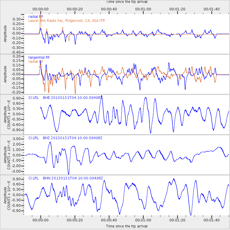
LRL Laurel Mtn Radio Fac, Ridgecrest, CA, USA - Earthquake Result Viewer
*The percent match for this event was below the threshold and hence no stack was calculated.
| Earthquake location: |
Santa Cruz Islands |
| Earthquake latitude/longitude: |
-10.7/166.4 |
| Earthquake time(UTC): |
2013/01/31 (031) 03:57:56 GMT |
| Earthquake Depth: |
10 km |
| Earthquake Magnitude: |
5.6 MB, 5.9 MS, 5.8 MW |
| Earthquake Catalog/Contributor: |
WHDF/NEIC |
|
| Network: |
CI Caltech Regional Seismic Network |
| Station: |
LRL Laurel Mtn Radio Fac, Ridgecrest, CA, USA |
| Lat/Lon: |
35.48 N/117.68 W |
| Elevation: |
1340 m |
|
| Distance: |
84.9 deg |
| Az: |
52.638 deg |
| Baz: |
253.175 deg |
| Ray Param: |
$rayparam |
*The percent match for this event was below the threshold and hence was not used in the summary stack. |
|
| Radial Match: |
59.963013 % |
| Radial Bump: |
327 |
| Transverse Match: |
49.962044 % |
| Transverse Bump: |
358 |
| SOD ConfigId: |
494114 |
| Insert Time: |
2013-04-27 04:57:16.403 +0000 |
| GWidth: |
2.5 |
| Max Bumps: |
400 |
| Tol: |
0.001 |
|
Signal To Noise
| Channel | StoN | STA | LTA |
| CI:LRL: :BHZ:20130131T04:10:00.09498Z | 4.53004 | 7.8817015E-7 | 1.7398747E-7 |
| CI:LRL: :BHN:20130131T04:10:00.09498Z | 0.8810135 | 2.3533593E-7 | 2.6711956E-7 |
| CI:LRL: :BHE:20130131T04:10:00.09498Z | 0.83129144 | 2.8466823E-7 | 3.4244096E-7 |
| Arrivals |
| Ps | |
| PpPs | |
| PsPs/PpSs | |


