
BDFB Brasilia, Brazil - Earthquake Result Viewer
| ||||||||||||||||||
| ||||||||||||||||||
| ||||||||||||||||||
|
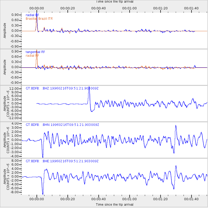
Signal To Noise
| Channel | StoN | STA | LTA |
| GT:BDFB: :BHN:19960216T09:51:21.903009Z | 10.177413 | 1.430246E-6 | 1.405314E-7 |
| GT:BDFB: :BHE:19960216T09:51:21.903009Z | 22.617388 | 3.1709503E-6 | 1.4019967E-7 |
| GT:BDFB: :BHZ:19960216T09:51:21.903009Z | 24.035046 | 4.929786E-6 | 2.0510824E-7 |
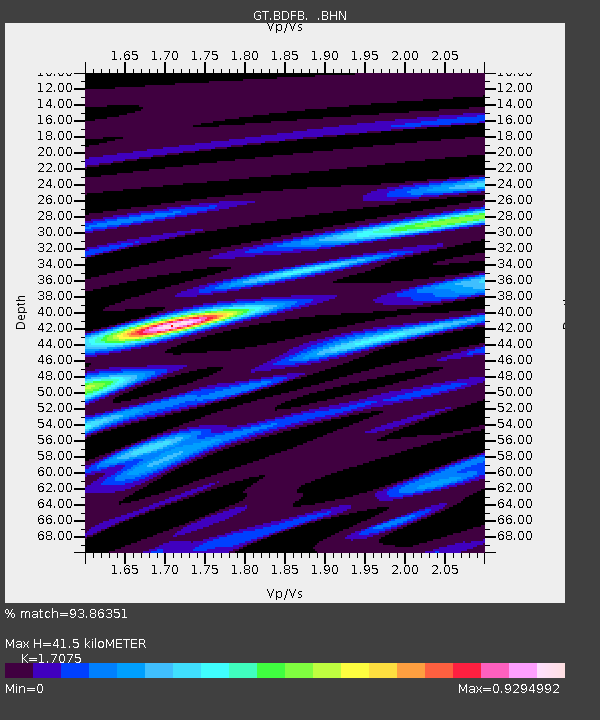
| Arrivals | |
| Ps | 4.9 SECOND |
| PpPs | 16 SECOND |
| PsPs/PpSs | 21 SECOND |

