BDFB Brasilia, Brazil - Earthquake Result Viewer
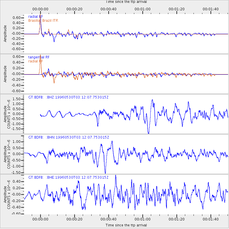
Earthquake location: South Sandwich Islands Region
Earthquake latitude/longitude: -56.7/-26.3
Earthquake time(UTC): 1996/05/30 (151) 03:04:37 GMT
Earthquake Depth: 84 km
Earthquake Magnitude: 5.7 MB, 6.1 UNKNOWN, 5.3 MW
Earthquake Catalog/Contributor: WHDF/NEIC
Network: GT Global Telemetered Seismograph Network (USAF/USGS)
Station: BDFB Brasilia, Brazil
Lat/Lon: 15.64 S/48.01 W
Elevation: 1195 m
Distance: 44.2 deg
Az: 329.26 deg
Baz: 162.993 deg
Ray Param: 0.07180355
Estimated Moho Depth: 41.75 km
Estimated Crust Vp/Vs: 1.66
Assumed Crust Vp: 6.419 km/s
Estimated Crust Vs: 3.873 km/s
Estimated Crust Poisson's Ratio: 0.21
Radial Match: 85.45306 %
Radial Bump: 400
Transverse Match: 63.860134 %
Transverse Bump: 400
SOD ConfigId: 6273
Insert Time: 2010-02-27 01:35:58.946 +0000
GWidth: 2.5
Max Bumps: 400
Tol: 0.001

Signal To Noise

ChannelStoNSTALTA
GT:BDFB: :BHN:19960530T03:12:07.753015Z2.28393442.834297E-71.2409714E-7
GT:BDFB: :BHE:19960530T03:12:07.753015Z1.78622751.4543117E-78.141806E-8
GT:BDFB: :BHZ:19960530T03:12:07.753015Z2.24884223.9191278E-71.7427314E-7
Arrivals
Ps4.6 SECOND
PpPs16 SECOND
PsPs/PpSs21 SECOND