BDFB Brasilia, Brazil - Earthquake Result Viewer
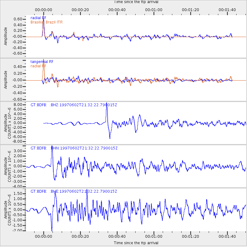
Earthquake location: South Sandwich Islands Region
Earthquake latitude/longitude: -57.8/-25.5
Earthquake time(UTC): 1997/06/02 (153) 21:24:38 GMT
Earthquake Depth: 33 km
Earthquake Magnitude: 5.9 MB, 5.8 MS, 6.1 UNKNOWN, 6.1 MW
Earthquake Catalog/Contributor: WHDF/NEIC
Network: GT Global Telemetered Seismograph Network (USAF/USGS)
Station: BDFB Brasilia, Brazil
Lat/Lon: 15.64 S/48.01 W
Elevation: 1195 m
Distance: 45.3 deg
Az: 328.704 deg
Baz: 163.208 deg
Ray Param: 0.071279414
Estimated Moho Depth: 40.0 km
Estimated Crust Vp/Vs: 1.69
Assumed Crust Vp: 6.419 km/s
Estimated Crust Vs: 3.798 km/s
Estimated Crust Poisson's Ratio: 0.23
Radial Match: 84.66462 %
Radial Bump: 400
Transverse Match: 74.98974 %
Transverse Bump: 400
SOD ConfigId: 6273
Insert Time: 2010-02-27 01:36:10.711 +0000
GWidth: 2.5
Max Bumps: 400
Tol: 0.001

Signal To Noise

ChannelStoNSTALTA
GT:BDFB: :BHN:19970602T21:32:22.790015Z5.49616341.28783E-62.3431433E-7
GT:BDFB: :BHE:19970602T21:32:22.790015Z4.2357936.359053E-71.5012662E-7
GT:BDFB: :BHZ:19970602T21:32:22.790015Z8.11504652.7703566E-63.4138517E-7
Arrivals
Ps4.6 SECOND
PpPs16 SECOND
PsPs/PpSs20 SECOND