HEH Heihe,Heilongjiang Province - Earthquake Result Viewer
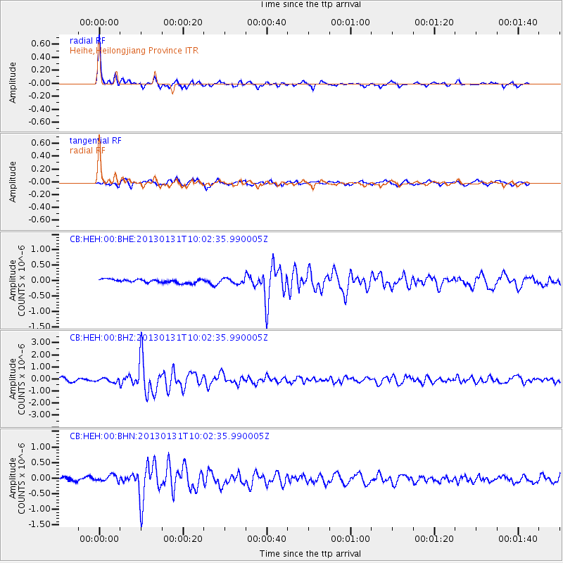
Earthquake location: Off Coast Of Southeastern Alaska
Earthquake latitude/longitude: 55.4/-135.0
Earthquake time(UTC): 2013/01/31 (031) 09:53:40 GMT
Earthquake Depth: 13 km
Earthquake Magnitude: 5.6 MB, 5.7 MS, 5.9 MW, 5.9 MW
Earthquake Catalog/Contributor: WHDF/NEIC
Network: CB China National Seismic Network
Station: HEH Heihe,Heilongjiang Province
Lat/Lon: 50.25 N/127.41 E
Elevation: 165 m
Distance: 54.4 deg
Az: 308.518 deg
Baz: 43.998 deg
Ray Param: 0.06545108
Estimated Moho Depth: 33.25 km
Estimated Crust Vp/Vs: 1.70
Assumed Crust Vp: 6.419 km/s
Estimated Crust Vs: 3.787 km/s
Estimated Crust Poisson's Ratio: 0.23
Radial Match: 94.18632 %
Radial Bump: 281
Transverse Match: 77.12828 %
Transverse Bump: 400
SOD ConfigId: 494114
Insert Time: 2013-04-27 05:16:27.967 +0000
GWidth: 2.5
Max Bumps: 400
Tol: 0.001

Signal To Noise

ChannelStoNSTALTA
CB:HEH:00:BHZ:20130131T10:02:35.990005Z1.20235091.5996461E-71.3304322E-7
CB:HEH:00:BHN:20130131T10:02:35.990005Z1.88914451.13892995E-76.028814E-8
CB:HEH:00:BHE:20130131T10:02:35.990005Z1.42068378.284761E-85.8315308E-8
Arrivals
Ps3.8 SECOND
PpPs13 SECOND
PsPs/PpSs17 SECOND