BDFB Brasilia, Brazil - Earthquake Result Viewer
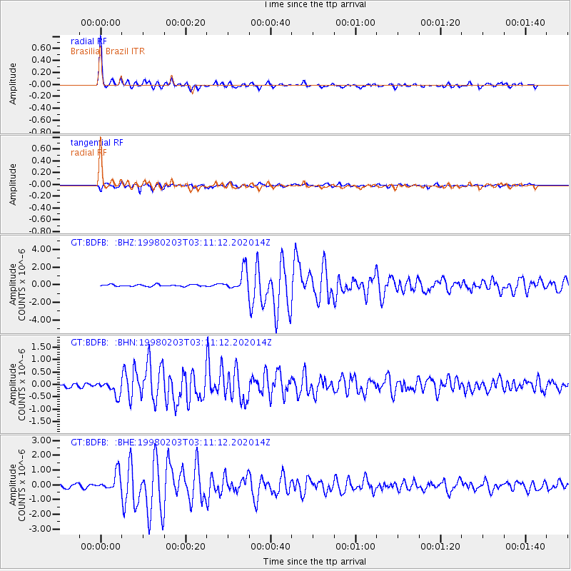
Earthquake location: Near Coast Of Oaxaca, Mexico
Earthquake latitude/longitude: 15.9/-96.3
Earthquake time(UTC): 1998/02/03 (034) 03:02:00 GMT
Earthquake Depth: 33 km
Earthquake Magnitude: 6.0 MB, 6.2 MS, 6.3 UNKNOWN, 6.4 MD
Earthquake Catalog/Contributor: WHDF/NEIC
Network: GT Global Telemetered Seismograph Network (USAF/USGS)
Station: BDFB Brasilia, Brazil
Lat/Lon: 15.64 S/48.01 W
Elevation: 1195 m
Distance: 57.0 deg
Az: 121.006 deg
Baz: 301.118 deg
Ray Param: 0.063689075
Estimated Moho Depth: 42.25 km
Estimated Crust Vp/Vs: 1.68
Assumed Crust Vp: 6.419 km/s
Estimated Crust Vs: 3.821 km/s
Estimated Crust Poisson's Ratio: 0.23
Radial Match: 94.88158 %
Radial Bump: 373
Transverse Match: 91.26716 %
Transverse Bump: 400
SOD ConfigId: 6273
Insert Time: 2010-02-27 01:36:19.910 +0000
GWidth: 2.5
Max Bumps: 400
Tol: 0.001

Signal To Noise

ChannelStoNSTALTA
GT:BDFB: :BHN:19980203T03:11:12.202014Z3.36606962.8950066E-78.600555E-8
GT:BDFB: :BHE:19980203T03:11:12.202014Z3.83387186.315926E-71.6474016E-7
GT:BDFB: :BHZ:19980203T03:11:12.202014Z12.3978081.2510285E-61.0090723E-7
Arrivals
Ps4.7 SECOND
PpPs17 SECOND
PsPs/PpSs21 SECOND