
BDFB Brasilia, Brazil - Earthquake Result Viewer
| ||||||||||||||||||
| ||||||||||||||||||
| ||||||||||||||||||
|
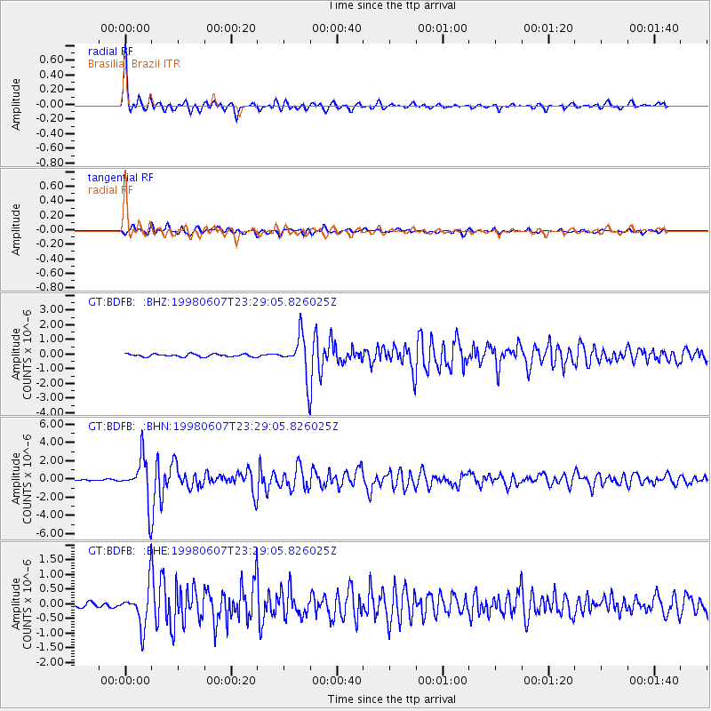
Signal To Noise
| Channel | StoN | STA | LTA |
| GT:BDFB: :BHN:19980607T23:29:05.826025Z | 23.460196 | 2.5129316E-6 | 1.07114694E-7 |
| GT:BDFB: :BHE:19980607T23:29:05.826025Z | 6.932751 | 6.893979E-7 | 9.944074E-8 |
| GT:BDFB: :BHZ:19980607T23:29:05.826025Z | 13.907659 | 1.3305804E-6 | 9.56725E-8 |
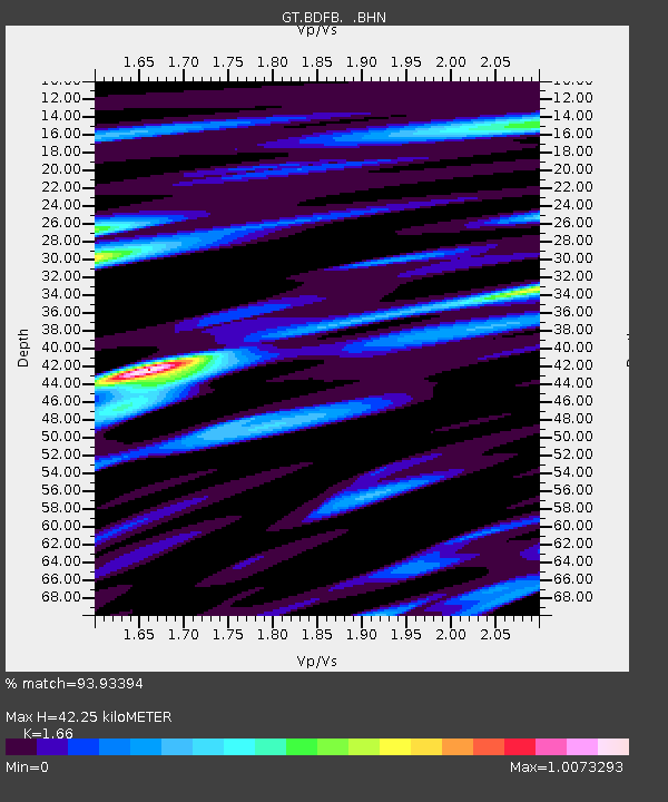
| Arrivals | |
| Ps | 4.6 SECOND |
| PpPs | 17 SECOND |
| PsPs/PpSs | 21 SECOND |

