You are here: Home > Network List > TA - USArray Transportable Network (new EarthScope stations) Stations List
> Station Y44A Strider, Charleston, MS, USA > Earthquake Result Viewer
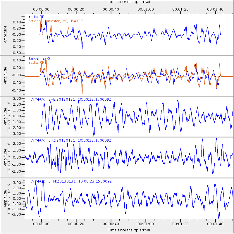
Y44A Strider, Charleston, MS, USA - Earthquake Result Viewer
*The percent match for this event was below the threshold and hence no stack was calculated.
| Earthquake location: |
Off Coast Of Southeastern Alaska |
| Earthquake latitude/longitude: |
55.4/-135.0 |
| Earthquake time(UTC): |
2013/01/31 (031) 09:53:40 GMT |
| Earthquake Depth: |
13 km |
| Earthquake Magnitude: |
5.6 MB, 5.7 MS, 5.9 MW, 5.9 MW |
| Earthquake Catalog/Contributor: |
WHDF/NEIC |
|
| Network: |
TA USArray Transportable Network (new EarthScope stations) |
| Station: |
Y44A Strider, Charleston, MS, USA |
| Lat/Lon: |
33.96 N/90.21 W |
| Elevation: |
46 m |
|
| Distance: |
37.5 deg |
| Az: |
105.971 deg |
| Baz: |
318.758 deg |
| Ray Param: |
$rayparam |
*The percent match for this event was below the threshold and hence was not used in the summary stack. |
|
| Radial Match: |
44.015064 % |
| Radial Bump: |
374 |
| Transverse Match: |
55.05113 % |
| Transverse Bump: |
352 |
| SOD ConfigId: |
494114 |
| Insert Time: |
2013-04-27 05:19:58.990 +0000 |
| GWidth: |
2.5 |
| Max Bumps: |
400 |
| Tol: |
0.001 |
|
Signal To Noise
| Channel | StoN | STA | LTA |
| TA:Y44A: :BHZ:20130131T10:00:23.150009Z | 1.2457387 | 6.5095696E-7 | 5.2254694E-7 |
| TA:Y44A: :BHN:20130131T10:00:23.150009Z | 1.8113232 | 1.9104516E-6 | 1.0547271E-6 |
| TA:Y44A: :BHE:20130131T10:00:23.150009Z | 1.2922304 | 1.7805376E-6 | 1.3778794E-6 |
| Arrivals |
| Ps | |
| PpPs | |
| PsPs/PpSs | |


