You are here: Home > Network List > TA - USArray Transportable Network (new EarthScope stations) Stations List
> Station X41A Kaden, Bauxite, AR, USA > Earthquake Result Viewer
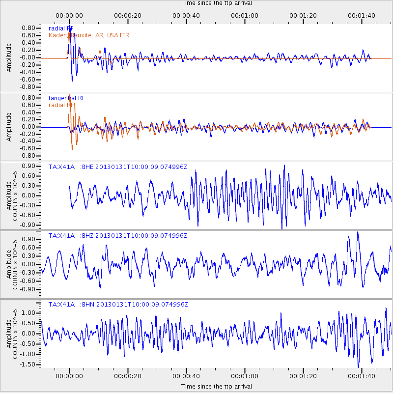
X41A Kaden, Bauxite, AR, USA - Earthquake Result Viewer
*The percent match for this event was below the threshold and hence no stack was calculated.
| Earthquake location: |
Off Coast Of Southeastern Alaska |
| Earthquake latitude/longitude: |
55.4/-135.0 |
| Earthquake time(UTC): |
2013/01/31 (031) 09:53:40 GMT |
| Earthquake Depth: |
13 km |
| Earthquake Magnitude: |
5.6 MB, 5.7 MS, 5.9 MW, 5.9 MW |
| Earthquake Catalog/Contributor: |
WHDF/NEIC |
|
| Network: |
TA USArray Transportable Network (new EarthScope stations) |
| Station: |
X41A Kaden, Bauxite, AR, USA |
| Lat/Lon: |
34.49 N/92.51 W |
| Elevation: |
102 m |
|
| Distance: |
35.9 deg |
| Az: |
107.788 deg |
| Baz: |
318.926 deg |
| Ray Param: |
$rayparam |
*The percent match for this event was below the threshold and hence was not used in the summary stack. |
|
| Radial Match: |
60.20744 % |
| Radial Bump: |
400 |
| Transverse Match: |
52.58765 % |
| Transverse Bump: |
400 |
| SOD ConfigId: |
494114 |
| Insert Time: |
2013-04-27 05:20:12.744 +0000 |
| GWidth: |
2.5 |
| Max Bumps: |
400 |
| Tol: |
0.001 |
|
Signal To Noise
| Channel | StoN | STA | LTA |
| TA:X41A: :BHZ:20130131T10:00:09.074996Z | 2.1518865 | 3.5514677E-7 | 1.6503974E-7 |
| TA:X41A: :BHN:20130131T10:00:09.074996Z | 0.8041788 | 1.7375494E-7 | 2.1606506E-7 |
| TA:X41A: :BHE:20130131T10:00:09.074996Z | 0.73998165 | 1.5110628E-7 | 2.0420273E-7 |
| Arrivals |
| Ps | |
| PpPs | |
| PsPs/PpSs | |


